Approximate Location Map
Large Map »
Latitude: 50.7417 / 50°44'30"N
Longitude: -1.5514 / 1°33'4"W
OS Eastings: 431751
OS Northings: 93663
OS Grid: SZ317936
Mapcode National: GBR 66Y.JKP
Mapcode Global: FRA 77M3.ZCF
Plus Code: 9C2WPCRX+MF
Entry Name: Sadleir's
Listing Date: 28 October 1974
Grade: II
Source: Historic England
Source ID: 1275126
English Heritage Legacy ID: 413255
ID on this website: 101275126
Location: Lower Pennington, New Forest, Hampshire, SO41
County: Hampshire
District: New Forest
Civil Parish: Lymington and Pennington
Traditional County: Hampshire
Lieutenancy Area (Ceremonial County): Hampshire
Church of England Parish: Pennington St Mark
Church of England Diocese: Winchester
Tagged with: Building
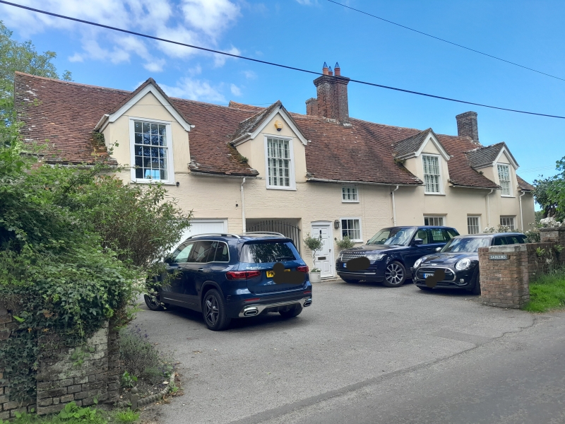
1.
5235 LOWER PENNINGTON LANE
(East Side)
PENNNINGTON
---------------------
Sadleir's
SZ 30 SW 8/248
II GV
2.
Early C19 facade, probably to earlier building. Part of same building as Sadleir's
(qv) and both formerly Sadlers Farmhouse. Stucco - probably over cob. Double
span tiled roof, 1½ storeys. 2 large gabled dormers break through eaves, 3 windows
ground floor. All sashes with glazing bars. Rear part projects to south and forms
a 1 bay, 1½ storey extension here with hipped dormer and similar windows.
Sadleir's Mews and Sadleir's form a group.
Listing NGR: SZ3175493670
External links are from the relevant listing authority and, where applicable, Wikidata. Wikidata IDs may be related buildings as well as this specific building. If you want to add or update a link, you will need to do so by editing the Wikidata entry.


Other nearby listed buildings
