Approximate Location Map
Large Map »
Latitude: 50.9852 / 50°59'6"N
Longitude: 0.4745 / 0°28'28"E
OS Eastings: 573776
OS Northings: 123555
OS Grid: TQ737235
Mapcode National: GBR PVN.0T1
Mapcode Global: FRA C6WH.W33
Plus Code: 9F22XFPF+3Q
Entry Name: 55, 57 and 59, High Street
Listing Date: 3 August 1961
Grade: II
Source: Historic England
Source ID: 1275151
English Heritage Legacy ID: 413174
ID on this website: 101275151
Location: Robertsbridge, Rother, East Sussex, TN32
County: East Sussex
District: Rother
Civil Parish: Salehurst and Robertsbridge
Built-Up Area: Robertsbridge
Traditional County: Sussex
Lieutenancy Area (Ceremonial County): East Sussex
Church of England Parish: Salehurst St Mary
Church of England Diocese: Chichester
Tagged with: Building
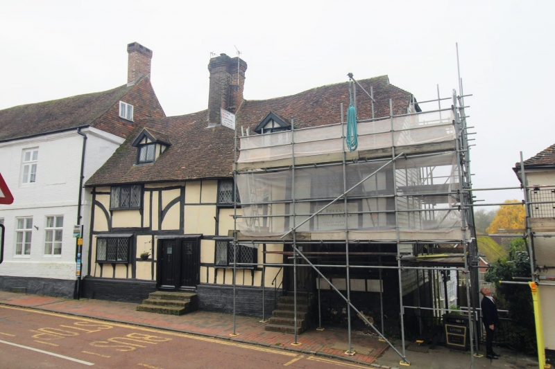
TQ 7223-7323 SALEHURST HIGH STREET,
Robertsbridge
42/23 (west side)
3.8.61 Nos 55, 57 and 59
GV II
One building. C17 or earlier timber-framed building with plaster infilling on a
base of brick and stone. Tiled roof. Casement windows.
Listing NGR: TQ7377623555
External links are from the relevant listing authority and, where applicable, Wikidata. Wikidata IDs may be related buildings as well as this specific building. If you want to add or update a link, you will need to do so by editing the Wikidata entry.


Other nearby listed buildings
