Approximate Location Map
Large Map »
Latitude: 51.0011 / 51°0'3"N
Longitude: -0.8001 / 0°48'0"W
OS Eastings: 484293
OS Northings: 123095
OS Grid: SU842230
Mapcode National: GBR DDT.2KC
Mapcode Global: FRA 966G.Q3J
Plus Code: 9C3X252X+CX
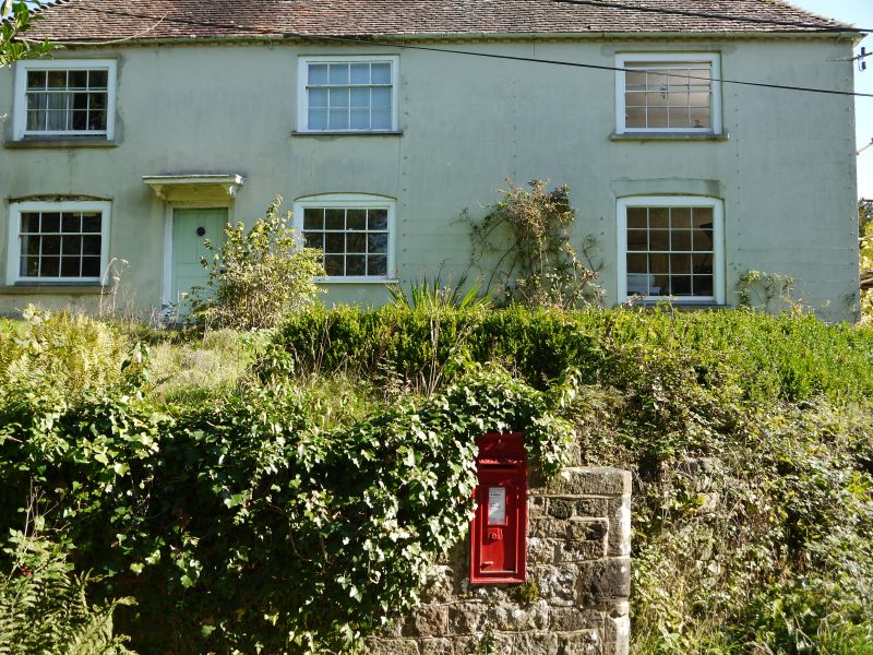
Entry Name: Chithurst Farmhouse
Listing Date: 26 November 1987
Grade: II
Source: Historic England
Source ID: 1275255
English Heritage Legacy ID: 413018
ID on this website: 101275255
Location: Chithurst, Chichester, West Sussex, GU31
County: West Sussex
District: Chichester
Civil Parish: Trotton with Chithurst
Traditional County: Sussex
Lieutenancy Area (Ceremonial County): West Sussex
Church of England Parish: Trotton
Church of England Diocese: Chichester
Tagged with: Farmhouse
SU 82 SW TROTTON WITH CHITHURST CHITHURST LANE
10/6 Chithurst Farmhouse
-
- II
Formerly listed under Chithurst parish. House. C17 or earlier timber-framed
building refaced in the C18 with stucco on a stone plinth. Dentilled eaves cornice.
Tiled roof with pentice to east. Glazing bars intact. Doorway with flat hood on
brackets. 2 storeys. 2 windows.
Listing NGR: SU8429523091
External links are from the relevant listing authority and, where applicable, Wikidata. Wikidata IDs may be related buildings as well as this specific building. If you want to add or update a link, you will need to do so by editing the Wikidata entry.


Other nearby listed buildings
