Approximate Location Map
Large Map »
Latitude: 51.0045 / 51°0'16"N
Longitude: -0.8501 / 0°51'0"W
OS Eastings: 480774
OS Northings: 123419
OS Grid: SU807234
Mapcode National: GBR CC7.V7F
Mapcode Global: FRA 963G.8MK
Plus Code: 9C3X243X+QW
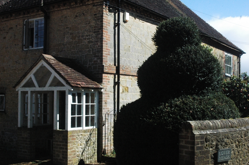
Entry Name: Lower Meads
Listing Date: 26 November 1987
Grade: II
Source: Historic England
Source ID: 1275616
English Heritage Legacy ID: 411733
ID on this website: 101275616
Location: Rogate, Chichester, West Sussex, GU31
County: West Sussex
District: Chichester
Civil Parish: Rogate
Traditional County: Sussex
Lieutenancy Area (Ceremonial County): West Sussex
Church of England Parish: Rogate St Bartholomew with Terwick St Peter
Church of England Diocese: Chichester
Tagged with: Architectural structure
ROGATE HABIN ROAD
SU 8023, 8123
20/22 Lower Meads
-
- II
House. C18. Ashlar, set in galletting with red brick dressings, quoins,
stringcourse and modillion eaves cornice. Hipped tiled roof. Vertical glazing
bars only intact. Two storeys. Three windows.
Listing NGR: SU8077423419
External links are from the relevant listing authority and, where applicable, Wikidata. Wikidata IDs may be related buildings as well as this specific building. If you want to add or update a link, you will need to do so by editing the Wikidata entry.


Other nearby listed buildings
