Latitude: 51.1837 / 51°11'1"N
Longitude: 0.9373 / 0°56'14"E
OS Eastings: 605374
OS Northings: 146823
OS Grid: TR053468
Mapcode National: GBR SXQ.PSX
Mapcode Global: VHKKH.6HCX
Plus Code: 9F325WMP+FW
Entry Name: 39, Church Street
Listing Date: 16 February 1989
Grade: II
Source: Historic England
Source ID: 1275712
English Heritage Legacy ID: 411469
ID on this website: 101275712
Location: Wye, Ashford, Kent, TN25
County: Kent
District: Ashford
Civil Parish: Wye with Hinxhill
Built-Up Area: Wye
Traditional County: Kent
Lieutenancy Area (Ceremonial County): Kent
Tagged with: Building
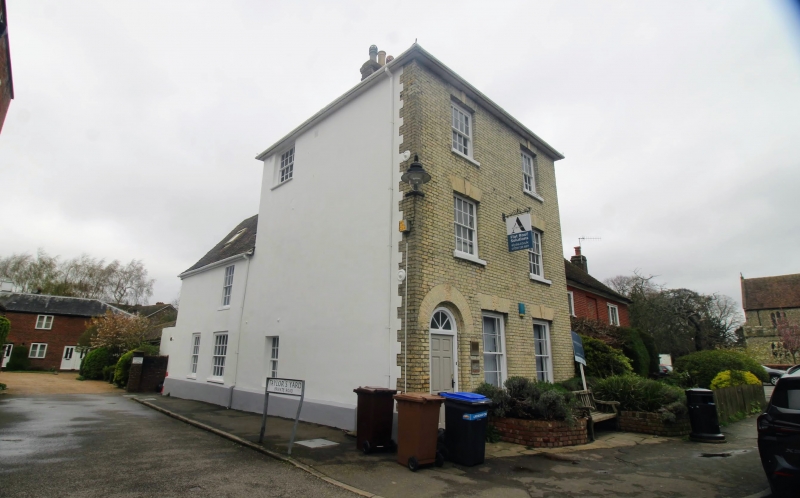
TR 0446 0546 WYE CHURCH STREET
(west side)
8/239 No. 39
GV II
House. Early C19. Roughcast with plain tiled roof. Three storeys on
plinth with hipped roof and stack to rear. Two glazing bar sashes on each
of 2nd and 1st floors, and 2 margin light sashes on ground floor, with
panelled door to left, with semi-circular fanlight and rebated surround.
Two storey hipped range to rear, with glazing bar sashes. Included for
group value.
Listing NGR: TR0537446823
External links are from the relevant listing authority and, where applicable, Wikidata. Wikidata IDs may be related buildings as well as this specific building. If you want to add or update a link, you will need to do so by editing the Wikidata entry.


Other nearby listed buildings