Approximate Location Map
Large Map »
Latitude: 50.9606 / 50°57'38"N
Longitude: 0.4699 / 0°28'11"E
OS Eastings: 573550
OS Northings: 120814
OS Grid: TQ735208
Mapcode National: GBR PVT.RM9
Mapcode Global: FRA C6WK.T1D
Plus Code: 9F22XF69+6X
Entry Name: The Stables to South West of Mountfield Court
Listing Date: 13 May 1987
Grade: II
Source: Historic England
Source ID: 1275852
English Heritage Legacy ID: 411020
ID on this website: 101275852
Location: John's Cross, Rother, East Sussex, TN32
County: East Sussex
District: Rother
Civil Parish: Mountfield
Traditional County: Sussex
Lieutenancy Area (Ceremonial County): East Sussex
Church of England Parish: Mountfield All Saints
Church of England Diocese: Chichester
Tagged with: Stable
TQ 72 SW
12/20A
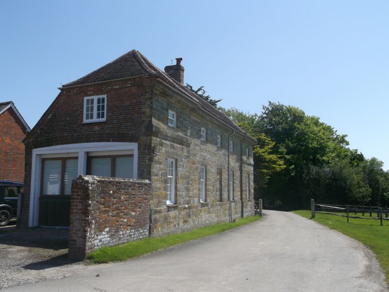
MOUNTFIELD
CHURCH ROAD
The Stables to SW of Mount field Court
II
C18. Two storeys. Five windows. Ashlar. Hipped tiled roof. Casement windows.
The end window bays are flanked by pilasters.
Listing NGR: TQ7355020814
External links are from the relevant listing authority and, where applicable, Wikidata. Wikidata IDs may be related buildings as well as this specific building. If you want to add or update a link, you will need to do so by editing the Wikidata entry.


Other nearby listed buildings
