Approximate Location Map
Large Map »
Latitude: 50.9294 / 50°55'45"N
Longitude: 0.707 / 0°42'25"E
OS Eastings: 590327
OS Northings: 117933
OS Grid: TQ903179
Mapcode National: GBR QXV.RKY
Mapcode Global: FRA D6CN.991
Plus Code: 9F22WPH4+QR
Entry Name: The Ferry
Listing Date: 13 May 1987
Grade: II
Source: Historic England
Source ID: 1275953
English Heritage Legacy ID: 410770
ID on this website: 101275953
Location: Winchelsea, Rother, East Sussex, TN36
County: East Sussex
District: Rother
Civil Parish: Icklesham
Traditional County: Sussex
Lieutenancy Area (Ceremonial County): East Sussex
Church of England Parish: Winchelsea
Church of England Diocese: Chichester
Tagged with: Architectural structure
TQ 9017-9117
51/81
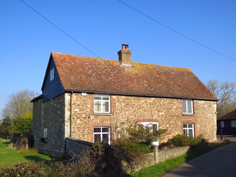
ICKLESHAM
STATION ROAD, WINCHELSEA
The Ferry
II
Formerly two cottages. C18 or earlier. Two storeys. Two windows. Stone rubble
with ashlar quoins and red brick window dressings. Tiled roof. Modern casement
windows.
Listing NGR: TQ9032717933
External links are from the relevant listing authority and, where applicable, Wikidata. Wikidata IDs may be related buildings as well as this specific building. If you want to add or update a link, you will need to do so by editing the Wikidata entry.


Other nearby listed buildings
