Approximate Location Map
Large Map »
Latitude: 55.7683 / 55°46'5"N
Longitude: -2.0054 / 2°0'19"W
OS Eastings: 399761
OS Northings: 652768
OS Grid: NT997527
Mapcode National: GBR G1FR.M2
Mapcode Global: WH9YK.58BT
Plus Code: 9C7VQX9V+8V
Entry Name: 3, Quay Walls
Listing Date: 30 November 1984
Grade: II
Source: Historic England
Source ID: 1276440
English Heritage Legacy ID: 409272
ID on this website: 101276440
Location: Berwick-upon-Tweed, Northumberland, TD15
County: Northumberland
Civil Parish: Berwick-upon-Tweed
Built-Up Area: Berwick-upon-Tweed
Traditional County: Northumberland
Lieutenancy Area (Ceremonial County): Northumberland
Church of England Parish: Berwick Holy Trinity and St Mary
Church of England Diocese: Newcastle
Tagged with: Building
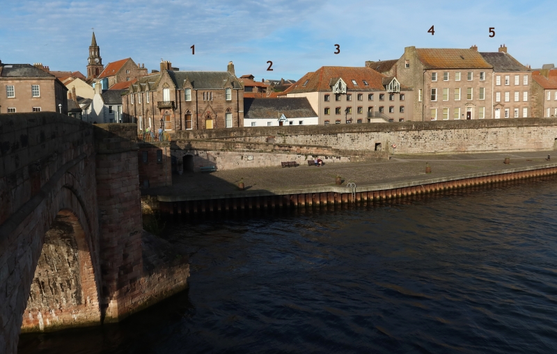
QUAY WALLS
No 3
1.
840
NT 9952 11/265
GV
II
2.
Granary now store and partly disused. Early C18 and later; of uncoursed rubble
sandstone, rendered and painted on the front elevation, under a steeply-pitched
pantiled roof. The eaves courses are of slate. Three storeys towards Quay Walls and
four to the rear where there is a rearward wing enclosing a courtyard. The front
range is eight windows in breadth and has two wide entrances from Quay Walls and an
external stairway rising to a central doorway at first floor level. From the lower
level of the quay a passageway through the walls gives on to the lower ground floor
and to the rear courtyard. The interior has open galleries at each level, each with
a central row of timber posts. Quay Walls at this point forms part of the Elizabethan
walled defences enclosing the town and No 3 is built into them. It is probably the
earliest surviving granary in the town.
Listing NGR: NT9976152768
External links are from the relevant listing authority and, where applicable, Wikidata. Wikidata IDs may be related buildings as well as this specific building. If you want to add or update a link, you will need to do so by editing the Wikidata entry.


Other nearby listed buildings
