Latitude: 50.9972 / 50°59'49"N
Longitude: 0.3819 / 0°22'54"E
OS Eastings: 567239
OS Northings: 124681
OS Grid: TQ672246
Mapcode National: GBR NT0.FD5
Mapcode Global: FRA C6PG.W23
Plus Code: 9F22X9WJ+VQ
Entry Name: Cherton
Listing Date: 13 May 1987
Grade: II
Source: Historic England
Source ID: 1276842
English Heritage Legacy ID: 408316
ID on this website: 101276842
Location: Burwash, Rother, East Sussex, TN19
County: East Sussex
District: Rother
Civil Parish: Burwash
Built-Up Area: Burwash
Traditional County: Sussex
Lieutenancy Area (Ceremonial County): East Sussex
Church of England Parish: Burwash St Bartholomew
Church of England Diocese: Chichester
Tagged with: Building
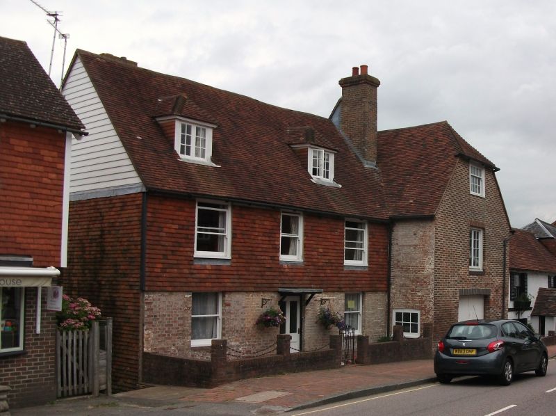
TQ 6624-6724 BURWASH HIGH STREET
(north side)
35/45 Cherton
GV II
L-shaped C18 building. Two storeys and attic. Four windows. Two dormers. Ground
floor painted brick, above tile-hung, the south east wing wholly red brick and
grey headers with half-hipped gable. Tiled roof. Glazing bars missing. Doorway
with flat hood on brackets.
Listing NGR: TQ6723924681
External links are from the relevant listing authority and, where applicable, Wikidata. Wikidata IDs may be related buildings as well as this specific building. If you want to add or update a link, you will need to do so by editing the Wikidata entry.


Other nearby listed buildings