Latitude: 53.1057 / 53°6'20"N
Longitude: -1.5637 / 1°33'49"W
OS Eastings: 429306
OS Northings: 356591
OS Grid: SK293565
Mapcode National: GBR 599.7GT
Mapcode Global: WHCDV.Y6KF
Plus Code: 9C5W4C4P+7G
Entry Name: 46-52, Cromford Hill
Listing Date: 12 September 1990
Grade: II
Source: Historic England
Source ID: 1277688
English Heritage Legacy ID: 430729
ID on this website: 101277688
Location: Cromford, Derbyshire Dales, Derbyshire, DE4
County: Derbyshire
District: Derbyshire Dales
Civil Parish: Cromford
Built-Up Area: Cromford
Traditional County: Derbyshire
Lieutenancy Area (Ceremonial County): Derbyshire
Church of England Parish: Cromford St Mary
Church of England Diocese: Derby
Tagged with: Building
1. CROMFORD HILL 1390 CROMFORD
Nos 46-52 (even) SK 2856/2956 1/119
II GV
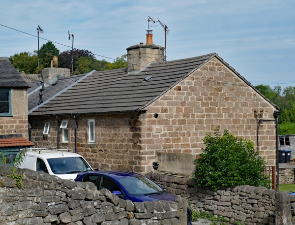
2. Row of four houses. Early C19 (marked on 1841 Tithe Map). Coursed rubble; Welsh slate roof to No. 50; reconstituted slab or corrugated concrete to others. Possibly built for Richard Arkwright to accommodate textile workers for his mills. 2 storeys. Plan a variant on Arkwright phase I type with side stairs against end and party walls behind front entrance; each house with 2 window bays; doorways under large lintel with no window above, the other bay with windows under cambered arch, now all with late-C20 casements or (to No. 48) top openers. Porch to No. 52.
Listing NGR: SK2930656591
External links are from the relevant listing authority and, where applicable, Wikidata. Wikidata IDs may be related buildings as well as this specific building. If you want to add or update a link, you will need to do so by editing the Wikidata entry.


Other nearby listed buildings