Approximate Location Map
Large Map »
Latitude: 51.1237 / 51°7'25"N
Longitude: -0.0065 / 0°0'23"W
OS Eastings: 539602
OS Northings: 137934
OS Grid: TQ396379
Mapcode National: GBR KLY.K4X
Mapcode Global: VHGSZ.T0XX
Plus Code: 9C3X4XFV+F9
Entry Name: 42 and 44, High Street
Listing Date: 2 August 1972
Grade: II
Source: Historic England
Source ID: 1277720
English Heritage Legacy ID: 430563
ID on this website: 101277720
Location: East Grinstead, Mid Sussex, RH19
County: West Sussex
District: Mid Sussex
Civil Parish: East Grinstead
Built-Up Area: East Grinstead
Traditional County: Sussex
Lieutenancy Area (Ceremonial County): West Sussex
Church of England Parish: East Grinstead St Swithun
Church of England Diocese: Chichester
Tagged with: Building
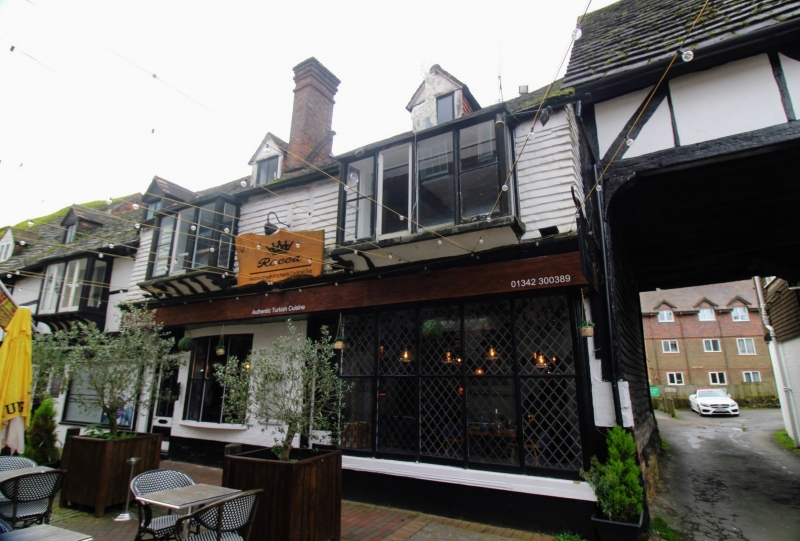
1.
1068 HIGH STREET
(South Side)
Nos 42 & 44
TQ 3937 1/33
II GV
2.
1 tile hung, overhanging, storey over shops. 2 early C19 oriel bays. 3
light casements. Tile roof.
Nos 34 to 50 (even) form a group.
Listing NGR: TQ3959937929
External links are from the relevant listing authority and, where applicable, Wikidata. Wikidata IDs may be related buildings as well as this specific building. If you want to add or update a link, you will need to do so by editing the Wikidata entry.


Other nearby listed buildings
