Latitude: 54.9345 / 54°56'4"N
Longitude: -1.5994 / 1°35'57"W
OS Eastings: 425768
OS Northings: 560053
OS Grid: NZ257600
Mapcode National: GBR KC8C.JX
Mapcode Global: WHC3Y.D7MH
Plus Code: 9C6WWCM2+Q7
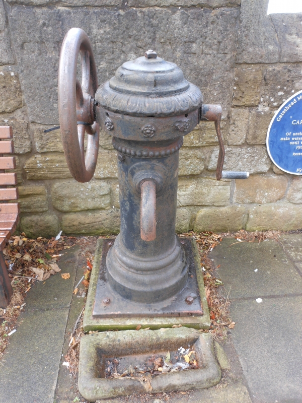
Entry Name: Carter's Well Opposite Methodist Church Hall
Listing Date: 13 January 1983
Grade: II
Source: Historic England
Source ID: 1277771
English Heritage Legacy ID: 430208
ID on this website: 101277771
Location: Low Fell, Gateshead, Tyne and Wear, NE9
County: Gateshead
Electoral Ward/Division: Low Fell
Parish: Non Civil Parish
Built-Up Area: Gateshead
Traditional County: Durham
Lieutenancy Area (Ceremonial County): Tyne and Wear
Church of England Parish: Gateshead St Helen
Church of England Diocese: Durham
Tagged with: Architectural structure
1. DURHAM ROAD
5099 (west side)
NZ 2560 10/78 Carter's Well opposite
Methodist Church Hall
II
2.
Later C19. Cast iron shaft with cornice and domed cap. Moulded base on stone
step. Spring handle on north side, spout (chipped) on east side above stone dog
trough.
Listing NGR: NZ2576860053
External links are from the relevant listing authority and, where applicable, Wikidata. Wikidata IDs may be related buildings as well as this specific building. If you want to add or update a link, you will need to do so by editing the Wikidata entry.


Other nearby listed buildings