Latitude: 50.9137 / 50°54'49"N
Longitude: 0.4911 / 0°29'27"E
OS Eastings: 575213
OS Northings: 115643
OS Grid: TQ752156
Mapcode National: GBR PWF.QYY
Mapcode Global: FRA C6XP.H4X
Plus Code: 9F22WF7R+FC
Entry Name: 41 and 42, Lower Lake
Listing Date: 13 May 1987
Grade: II
Source: Historic England
Source ID: 1278244
English Heritage Legacy ID: 292188
ID on this website: 101278244
Location: Battle, Rother, East Sussex, TN33
County: East Sussex
District: Rother
Civil Parish: Battle
Built-Up Area: Battle
Traditional County: Sussex
Lieutenancy Area (Ceremonial County): East Sussex
Church of England Parish: Battle St Mary the Virgin
Church of England Diocese: Chichester
Tagged with: Building
TQ 7415-7515
41/65
BATTLE
LOWER LAKE
(south west side)
Nos 41 and 42
GV
II
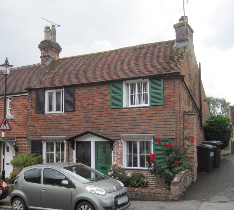
One building. Early C19. Two storeys. Two windows. Ground floor red brick,
above tile-hung. Tiled roof. Casement windows with Venetian shutters. Pair of
doorways with joint pediment over.
Listing NGR: TQ7521315643
External links are from the relevant listing authority and, where applicable, Wikidata. Wikidata IDs may be related buildings as well as this specific building. If you want to add or update a link, you will need to do so by editing the Wikidata entry.


Other nearby listed buildings