Latitude: 51.2627 / 51°15'45"N
Longitude: -1.0834 / 1°5'0"W
OS Eastings: 464050
OS Northings: 151898
OS Grid: SU640518
Mapcode National: GBR B6H.NXH
Mapcode Global: VHD08.5JLD
Plus Code: 9C3W7W78+3J
Entry Name: Eastlands
Listing Date: 6 November 1984
Grade: II
Source: Historic England
Source ID: 1278437
English Heritage Legacy ID: 137919
ID on this website: 101278437
Location: Basingstoke, Basingstoke and Deane, Hampshire, RG21
County: Hampshire
District: Basingstoke and Deane
Electoral Ward/Division: Eastrop
Parish: Non Civil Parish
Built-Up Area: Basingstoke
Traditional County: Hampshire
Lieutenancy Area (Ceremonial County): Hampshire
Church of England Parish: Eastrop St Mary
Church of England Diocese: Winchester
Tagged with: Building
SU 63-6451 (part) BASINGSTOKE LONDON ROAD
3/19
- Eastlands - II
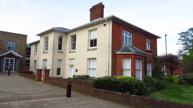
Early C19. Formerly a symmetrical facade (east front at right angles to road) with only slightly later northward extension, with a further recent addition at the north end. 2 storeys, 3-2 windows. Low-pitched slate roof with wide moulded eaves, the lower mouldings being carried round the top of pilasters and the central projection. Red brick walling in Flemish bond rubbed flat arches, stone cills, plinth. There are thin pilasters at each side and the north corner of the extension has Victorian sashes in reveals. A Tuscan porch of 2 columns, 2 pilasters (of thin proportions) on a moulded stone step, with an architrave enclosing an elaborate radiating fanlight, reeded door frame and 6-panelled double door. Internally a plain staircase.
Listing NGR: SU6404851903
External links are from the relevant listing authority and, where applicable, Wikidata. Wikidata IDs may be related buildings as well as this specific building. If you want to add or update a link, you will need to do so by editing the Wikidata entry.


Other nearby listed buildings