Approximate Location Map
Large Map »
Latitude: 52.7533 / 52°45'11"N
Longitude: -1.0835 / 1°5'0"W
OS Eastings: 461957
OS Northings: 317695
OS Grid: SK619176
Mapcode National: GBR 9MH.8XF
Mapcode Global: WHFK3.B291
Plus Code: 9C4WQW38+8J
Entry Name: Dovecote at Number 50 (The Firs)
Listing Date: 1 June 1966
Grade: II
Source: Historic England
Source ID: 1278541
English Heritage Legacy ID: 405446
ID on this website: 101278541
Location: Seagrave, Charnwood, Leicestershire, LE12
County: Leicestershire
District: Charnwood
Civil Parish: Seagrave
Built-Up Area: Seagrave
Traditional County: Leicestershire
Lieutenancy Area (Ceremonial County): Leicestershire
Church of England Parish: Seagrave All Saints
Church of England Diocese: Leicester
Tagged with: Dovecote
SEAGRAVE
SK 61 NW KING STREET (North Side)
4/138
1.6.66 Dovecote at No. 50
(The Firs)
II
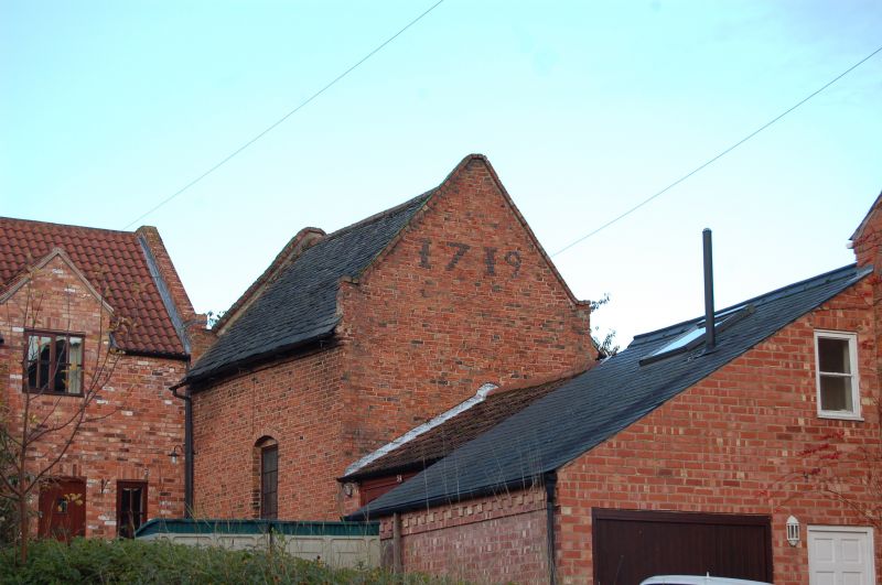
Dovecote. Dated 1719. Red brick with granite rubble stone plinth and moulded
brick eaves, and Swithland slate roof. Coped gables. Small dormer. Inside
are nesting boxes and 2 bay tie beam truss roof.
Listing NGR: SK6195717695
External links are from the relevant listing authority and, where applicable, Wikidata. Wikidata IDs may be related buildings as well as this specific building. If you want to add or update a link, you will need to do so by editing the Wikidata entry.


Other nearby listed buildings
