Latitude: 50.7001 / 50°42'0"N
Longitude: -1.291 / 1°17'27"W
OS Eastings: 450167
OS Northings: 89183
OS Grid: SZ501891
Mapcode National: GBR 8BJ.4D5
Mapcode Global: FRA 8757.BVK
Plus Code: 9C2WPP25+3J
Entry Name: Unitarian Chapel
Listing Date: 1 February 1972
Grade: II
Source: Historic England
Source ID: 1278755
English Heritage Legacy ID: 309528
Also known as: Newport Unitarian Chapel, Newport, Isle of Wight
ID on this website: 101278755
Location: Newport, Isle of Wight, PO30
County: Isle of Wight
Civil Parish: Newport
Built-Up Area: Newport
Traditional County: Hampshire
Lieutenancy Area (Ceremonial County): Isle of Wight
Church of England Parish: Newport St Thomas
Church of England Diocese: Portsmouth
Tagged with: Chapel
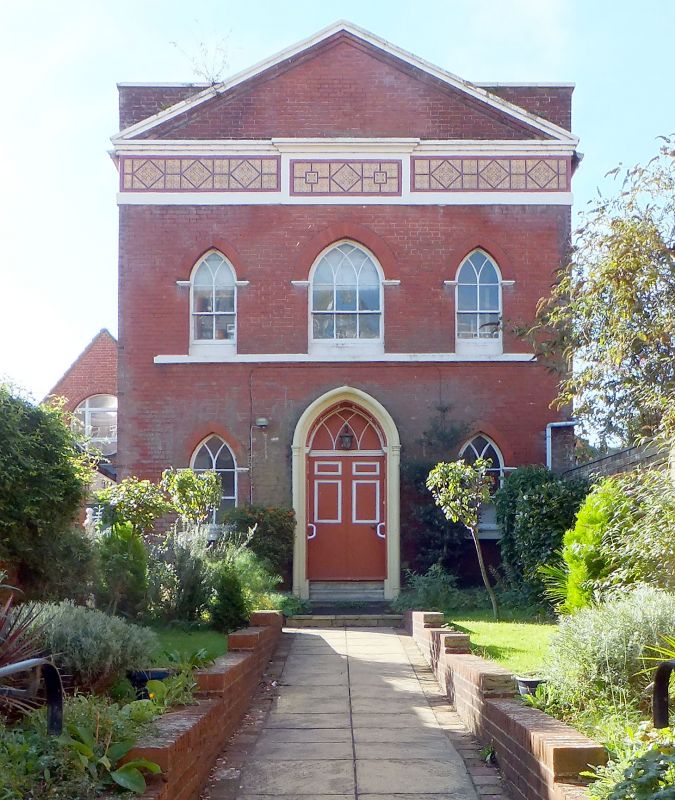
HIGH STREET 1. 1445 (South Side) SZ 5089 SW 3/187 Unitarian Chapel II 2. Set back from the street between Nos 9 and 10. Early C19 though the founding date is 1774. 2 storeys deep red brick with a full width brick pediment with painted coping, deep stucco frieze, with projecting centre panel, decorated with Chinoisaire incised pattern. 3 Gothic windows with intersecting glazing bars, the centre one wider and with continuous block sill on 1st floor, rubbed brick arches on thin stucco imposts. Central double doors with fielded panels blind pointed fanlight with intersecting glazing bars, panelled reveals and soffit. Stucco architrave surround with flanking colonettes and roll moulded arch over.
Listing NGR: SZ5016789183
External links are from the relevant listing authority and, where applicable, Wikidata. Wikidata IDs may be related buildings as well as this specific building. If you want to add or update a link, you will need to do so by editing the Wikidata entry.


Other nearby listed buildings