Latitude: 51.2315 / 51°13'53"N
Longitude: -0.3383 / 0°20'17"W
OS Eastings: 516114
OS Northings: 149351
OS Grid: TQ161493
Mapcode National: GBR HGH.R8G
Mapcode Global: VHGS7.390R
Plus Code: 9C3X6MJ6+JM
Entry Name: The Vicarage
Listing Date: 28 November 1951
Grade: II
Source: Historic England
Source ID: 1278810
English Heritage Legacy ID: 404796
ID on this website: 101278810
Location: Dorking, Mole Valley, Surrey, RH4
County: Surrey
District: Mole Valley
Electoral Ward/Division: Dorking South
Parish: Non Civil Parish
Built-Up Area: Dorking
Traditional County: Surrey
Lieutenancy Area (Ceremonial County): Surrey
Church of England Parish: Dorking St Martin
Church of England Diocese: Guildford
Tagged with: Clergy house
WEST STREET 1. 1049 (South Side) The Vicarage TQ 1649 SW 4/48 28.11.51.
II
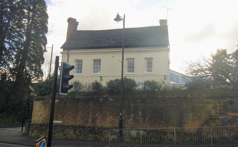
2. Until 1839 called Sondes Place. Large tall house of half H plan. The north wing appears to be C18 from the outside with the exception of a massive brick chimney breast at the east end with 2 tall stacks set diamond-wise on top. It is fronted with roughcast. 3 storeys. 4 windows. Stringcourse above ground floor. Coved cornice. Sash windows with glazing bars intact. The south wing is the oldest portion. C17 or earlier. Chimney breast with octagonal stacks. 3 storeys. 2 windows. Now fronted with red brick and grey headers alternately. Casement windows. The portion joining these 2 wings is C18. 2 storeys. 3 windows. Painted brick. Horsham slab roof to the whole house. Victorian and later additions at each end of the north wing. Photograph in the NMR.
Listing NGR: TQ1611449351
External links are from the relevant listing authority and, where applicable, Wikidata. Wikidata IDs may be related buildings as well as this specific building. If you want to add or update a link, you will need to do so by editing the Wikidata entry.


Other nearby listed buildings