Latitude: 50.7343 / 50°44'3"N
Longitude: -2.7618 / 2°45'42"W
OS Eastings: 346336
OS Northings: 93015
OS Grid: SY463930
Mapcode National: GBR PP.0B2C
Mapcode Global: FRA 5734.FW8
Plus Code: 9C2VP6MQ+P7
Entry Name: Bridge to West of West Mills
Listing Date: 30 October 1974
Grade: II
Source: Historic England
Source ID: 1279182
English Heritage Legacy ID: 404048
ID on this website: 101279182
Location: Bridport, Dorset, DT6
County: Dorset
Civil Parish: Bridport
Built-Up Area: Bridport
Traditional County: Dorset
Lieutenancy Area (Ceremonial County): Dorset
Church of England Parish: Bridport St Mary
Church of England Diocese: Salisbury
Tagged with: Bridge
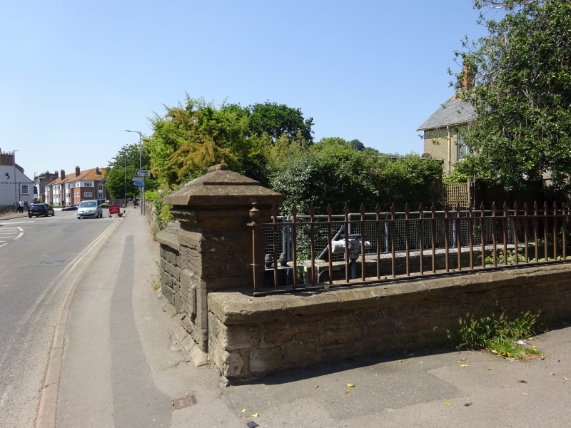
1.
5191 WEST STREET
(North Side)
Bridge to west of
West Mills
SY 4693 2/523 30.10.74.
II
2.
Mid C19. Ashlar. 3 segmental arches. Cutwaters. Low coped parapet, returned
west and then north at north end, and running as dwarf wall as far north as Mill
House. This wall has contemporary iron railings with ornamental spearhead finials.
Similar iron gate at north end.
Listing NGR: SY4633693015
External links are from the relevant listing authority and, where applicable, Wikidata. Wikidata IDs may be related buildings as well as this specific building. If you want to add or update a link, you will need to do so by editing the Wikidata entry.


Other nearby listed buildings