Approximate Location Map
Large Map »
Latitude: 50.7247 / 50°43'28"N
Longitude: -2.9337 / 2°56'1"W
OS Eastings: 334187
OS Northings: 92092
OS Grid: SY341920
Mapcode National: GBR PJ.CZGN
Mapcode Global: FRA 47R5.6X2
Plus Code: 9C2VP3F8+VG
Entry Name: Temple House
Listing Date: 23 April 1952
Grade: II
Source: Historic England
Source ID: 1279206
English Heritage Legacy ID: 404005
ID on this website: 101279206
Location: Lyme Regis, Dorset, DT7
County: Dorset
Civil Parish: Lyme Regis
Built-Up Area: Lyme Regis
Traditional County: Dorset
Lieutenancy Area (Ceremonial County): Dorset
Church of England Parish: Lyme Regis St Michael the Archangel
Church of England Diocese: Salisbury
Tagged with: House
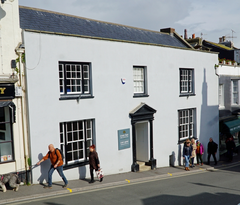
BROAD STREET
1.
1357
(North East Side)
No 63 (Temple House)
SY 3492 1/59 23.4.52.
II GV
2.
C18 front to possibly earlier core. 2 storeys. 3 window bays. Slate gabled
roof. Roughcast cladding to stone walls, parapet. Sash windows; 3 light sashes
to ends on 1st and ground floors. Central doorway with pilasters supporting
moulded and dentilled pediment. Cellars.
Nos 45 to 65 (consec) form a group.
Listing NGR: SY3418492092
External links are from the relevant listing authority and, where applicable, Wikidata. Wikidata IDs may be related buildings as well as this specific building. If you want to add or update a link, you will need to do so by editing the Wikidata entry.


Other nearby listed buildings
