Latitude: 50.7343 / 50°44'3"N
Longitude: -2.766 / 2°45'57"W
OS Eastings: 346037
OS Northings: 93020
OS Grid: SY460930
Mapcode National: GBR PP.08XN
Mapcode Global: FRA 5734.D7J
Plus Code: 9C2VP6MM+PH
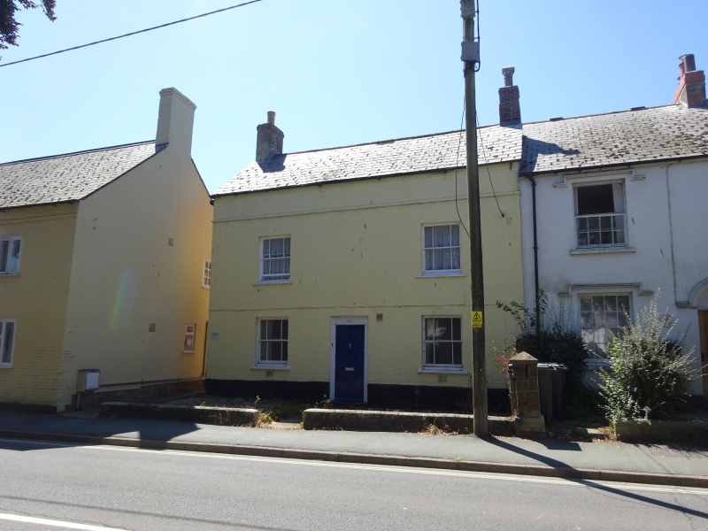
Entry Name: 61, West Allington
Listing Date: 19 September 1975
Grade: II
Source: Historic England
Source ID: 1279443
English Heritage Legacy ID: 403215
ID on this website: 101279443
Location: Allington, Dorset, DT6
County: Dorset
Civil Parish: Bridport
Built-Up Area: Bridport
Traditional County: Dorset
Lieutenancy Area (Ceremonial County): Dorset
Church of England Parish: Bridport St Mary
Church of England Diocese: Salisbury
Tagged with: Building
1. 5l91 WEST ALLINGTON (South Side)
No 61 SY 4693 2/484
IT GV
2. Early C19. Colour washed brick. Pitched slate roof. Red brick stacks. 2 storeys. Band above 1st floor. 2 ranges of sashes with glazing bars. Part-glazed door with moulded panels.
Nos 43 to 57 (odd), The Plymouth Inn, Nos 61 to 71 (odd) form a group.
Listing NGR: SY4603793020
External links are from the relevant listing authority and, where applicable, Wikidata. Wikidata IDs may be related buildings as well as this specific building. If you want to add or update a link, you will need to do so by editing the Wikidata entry.


Other nearby listed buildings