Approximate Location Map
Large Map »
Latitude: 52.6378 / 52°38'15"N
Longitude: -2.4904 / 2°29'25"W
OS Eastings: 366911
OS Northings: 304558
OS Grid: SJ669045
Mapcode National: GBR BW.6TWT
Mapcode Global: WH9D8.QY9Q
Plus Code: 9C4VJGQ5+4R
Entry Name: 31, Wellington Road
Listing Date: 9 August 1974
Grade: II
Source: Historic England
Source ID: 1280166
English Heritage Legacy ID: 361991
ID on this website: 101280166
Location: Coalbrookdale, Telford and Wrekin, Shropshire, TF8
County: Telford and Wrekin
Civil Parish: The Gorge
Built-Up Area: Telford
Traditional County: Shropshire
Lieutenancy Area (Ceremonial County): Shropshire
Church of England Parish: Coalbrookdale
Church of England Diocese: Hereford
Tagged with: Building
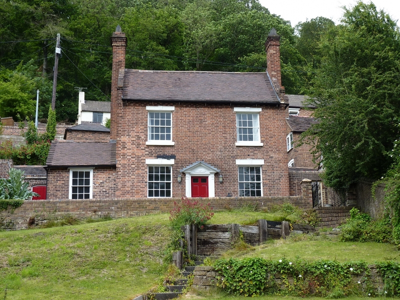
COALBROOKDALe WELLINGTON ROAD
1.
5362 (east side)
No 31
SJ 6604 9/127 9.8.74
II GV
2.
Early C19, the core probably earlier. Red brick; 2 storeys; 2 sash windows with
cast-iron lintels; wood pilaster doorcase with open pediment; modillion eaves; coped
gabled ends; brick stacks with cast-iron chimney pots; tile roof.
Listing NGR: SJ6691104558
External links are from the relevant listing authority and, where applicable, Wikidata. Wikidata IDs may be related buildings as well as this specific building. If you want to add or update a link, you will need to do so by editing the Wikidata entry.


Other nearby listed buildings
