Latitude: 51.23 / 51°13'47"N
Longitude: -3.8696 / 3°52'10"W
OS Eastings: 269556
OS Northings: 149525
OS Grid: SS695495
Mapcode National: GBR KZ.2ZDX
Mapcode Global: VH4M8.WB4Y
Plus Code: 9C3R64HJ+X5
Entry Name: Duty Point Tower
Listing Date: 3 September 1973
Last Amended: 9 June 1995
Grade: II
Source: Historic England
Source ID: 1280231
English Heritage Legacy ID: 376472
ID on this website: 101280231
Location: North Devon, EX35
County: Devon
District: North Devon
Civil Parish: Lynton and Lynmouth
Traditional County: Devon
Lieutenancy Area (Ceremonial County): Devon
Church of England Parish: Lynton St Mary the Virgin
Church of England Diocese: Exeter
Tagged with: Tower
LYNTON AND LYNMOUTH
SS64NE LEE ABBEY 858-1/1/63 Duty Point Tower 03/09/73 (Formerly Listed as: LYNTON Duty Point Tower near Lee Bay)
II
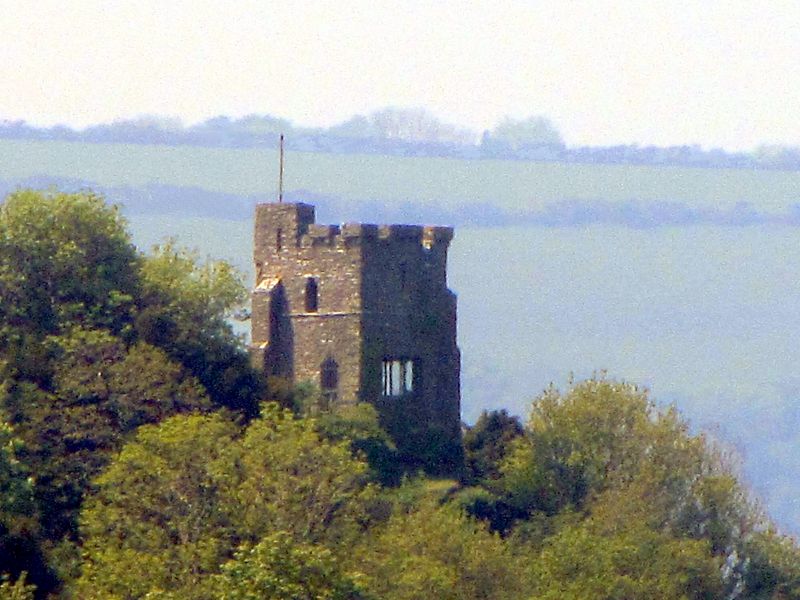
Folly tower. Mid C19. Rubble, flat roof not visible or accessible. A square tower at one of the highest points of the hill immediately to the N of Lee Abbey (qv). The tower is in 2 stages, with a flat roof, and has diagonal buttresses to 3 corners, and square buttresses to the SW corner; on the W side is a projecting square 'bay'. The plain walls are oversailed by heavy crenellations carried on corbels. To E and N are 3-light windows to concrete lintels, with a small slit window at the upper level on the N side, and the 'bay' has a 2-light. To the S is a simple doorway with flat arched 'Saxon' head. INTERIOR: a simple square room with concrete floor. To the left of the bay projection is a fireplace with brick arched opening, ceiling joists are carried on stone corbels. The upper chamber not accessible. This appears to have been built as a folly; whether there was ever any 'duty' required of it is not established, although it does have a commanding position overlooking the Bristol Channel, located 120m above sea level.
Listing NGR: SS6955649525
External links are from the relevant listing authority and, where applicable, Wikidata. Wikidata IDs may be related buildings as well as this specific building. If you want to add or update a link, you will need to do so by editing the Wikidata entry.


Other nearby listed buildings