Approximate Location Map
Large Map »
Latitude: 52.0534 / 52°3'12"N
Longitude: -2.7142 / 2°42'51"W
OS Eastings: 351122
OS Northings: 239683
OS Grid: SO511396
Mapcode National: GBR FL.DTL5
Mapcode Global: VH85N.WNZ7
Plus Code: 9C4V373P+88
Entry Name: Saint Ethelbert's Well
Listing Date: 22 October 1973
Grade: II
Source: Historic England
Source ID: 1280519
English Heritage Legacy ID: 372265
ID on this website: 101280519
Location: Portfields, County of Herefordshire, HR1
County: County of Herefordshire
Civil Parish: Hereford
Built-Up Area: Hereford
Traditional County: Herefordshire
Lieutenancy Area (Ceremonial County): Herefordshire
Church of England Parish: St Peter with St Owen and St James, Hereford
Church of England Diocese: Hereford
Tagged with: Well
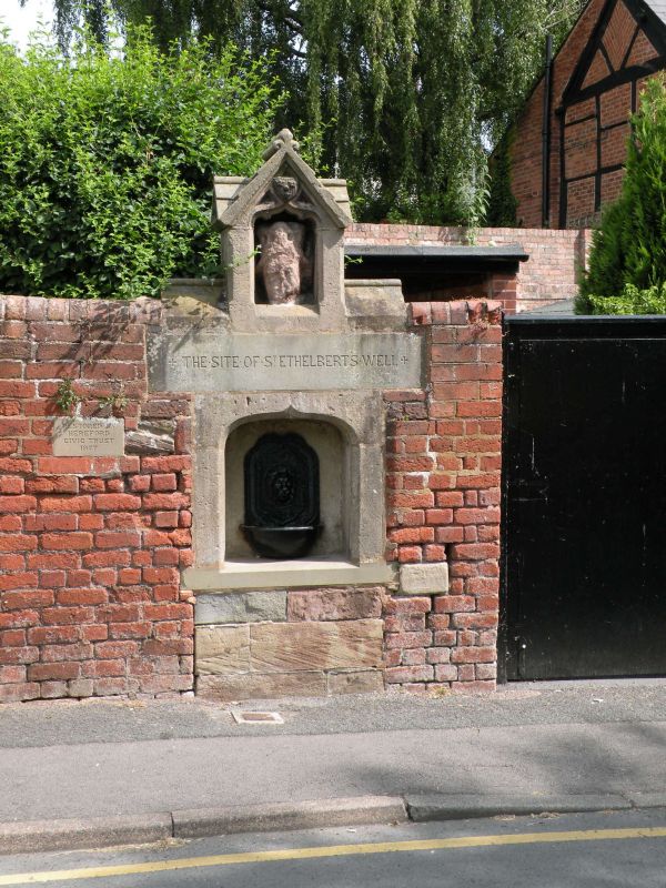
HEREFORD
SO5139NW CASTLE HILL
683-1/7/87 (North side)
22/10/73 St Ethelbert's Well
GV II
C19 cast-iron drinking fountain in ashlar niche with chamfered
4-centred arch; badly weathered C14 head of crowned king, over
(said to be from destroyed west front of Cathedral). Restored
1977.
Listing NGR: SO5112239683
External links are from the relevant listing authority and, where applicable, Wikidata. Wikidata IDs may be related buildings as well as this specific building. If you want to add or update a link, you will need to do so by editing the Wikidata entry.


Other nearby listed buildings
