Latitude: 52.6289 / 52°37'44"N
Longitude: 1.2989 / 1°17'56"E
OS Eastings: 623357
OS Northings: 308572
OS Grid: TG233085
Mapcode National: GBR W9V.MH
Mapcode Global: WHMTM.X5QY
Plus Code: 9F43J7HX+HH
Entry Name: Hardwick House
Listing Date: 23 October 1970
Grade: II
Source: Historic England
Source ID: 1280895
English Heritage Legacy ID: 228743
ID on this website: 101280895
Location: Norwich, Norfolk, NR1
County: Norfolk
District: Norwich
Electoral Ward/Division: Thorpe Hamlet
Parish: Non Civil Parish
Built-Up Area: Norwich
Traditional County: Norfolk
Lieutenancy Area (Ceremonial County): Norfolk
Church of England Parish: Norwich St George, Tombland
Church of England Diocese: Norwich
Tagged with: House
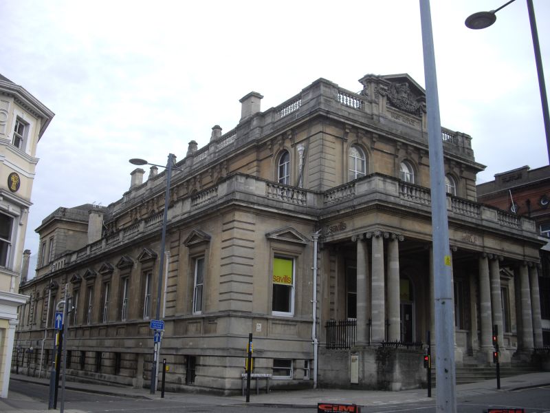
TG 2308 NW AGRICULTURAL HALL PLAIN (South side) 16/8 23.10.70. No.2. (Hardwick House) - II Former bank converted into Post Office, now offices. 1866 by P.C. Hardwick with C20 alterations. Bath stone. Roof not visible. Corner site. 2 storeys plus semi-basement in King Street. Elevation to Agricultural Hall Plain. 3 bays with single-storey bay to each side. Paired tetrastyle Ionic portico with 6 steps up and balustraded parapet continuing across outer single-storey bays. Central door with semi-circular arch and C20 glazed doors. Sash windows to each side with raised and moulded surrounds. Sash windows in outer bays with pediments. Casement windows at first floor with semi-circular arches having scroll keystone. Rusticated quoins. Central open pediment with garlands and crown. Projecting balustraded cornice. Elevation to King Street. Seven bays, one storey plus semi-basement, second storey deeply recessed. First and seventh bays project slightly. One sash under per bay in raised and moulded surround.
Listing NGR: TG2335708571
External links are from the relevant listing authority and, where applicable, Wikidata. Wikidata IDs may be related buildings as well as this specific building. If you want to add or update a link, you will need to do so by editing the Wikidata entry.


Other nearby listed buildings