Approximate Location Map
Large Map »
Latitude: 51.3885 / 51°23'18"N
Longitude: 1.3798 / 1°22'47"E
OS Eastings: 635248
OS Northings: 170921
OS Grid: TR352709
Mapcode National: GBR WZS.TZ9
Mapcode Global: VHLG6.VCTD
Plus Code: 9F3399QH+CW
Entry Name: 44, High Street
Listing Date: 22 February 1973
Grade: II
Source: Historic England
Source ID: 1281563
English Heritage Legacy ID: 356587
ID on this website: 101281563
Location: Margate, Thanet, Kent, CT9
County: Kent
District: Thanet
Electoral Ward/Division: Margate Central
Parish: Non Civil Parish
Built-Up Area: Margate
Traditional County: Kent
Lieutenancy Area (Ceremonial County): Kent
Tagged with: Building
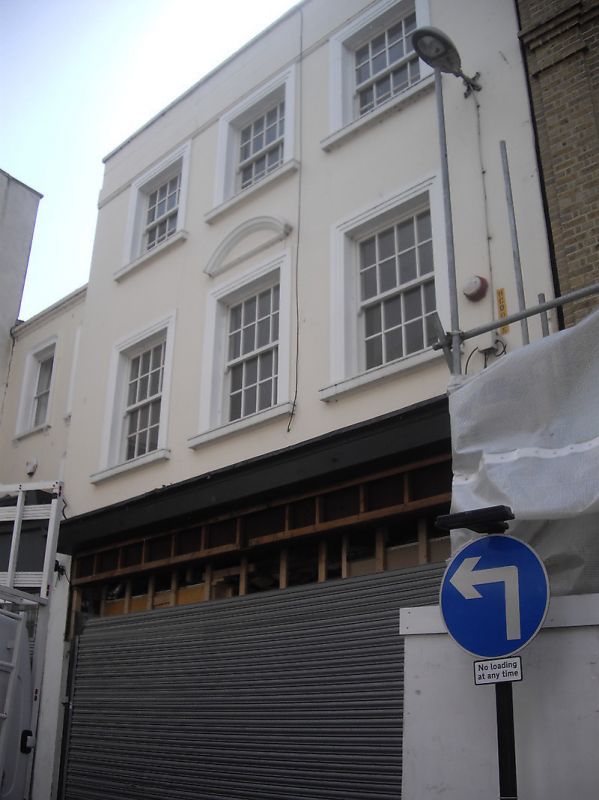
HIGH STREET
1.
1380
(West Side)
No 44
TR 3570 NW 1/190
II
2.
Circa 1840. 3 storeys stuccoed. Parapet with stone coping. 3 sashes set in
architraves with glazing bars intact. Curved pediment over 1st floor central
window. Modern shopfront.
Listing NGR: TR3524870921
External links are from the relevant listing authority and, where applicable, Wikidata. Wikidata IDs may be related buildings as well as this specific building. If you want to add or update a link, you will need to do so by editing the Wikidata entry.


Other nearby listed buildings
