Approximate Location Map
Large Map »
Latitude: 51.3915 / 51°23'29"N
Longitude: 1.3845 / 1°23'4"E
OS Eastings: 635559
OS Northings: 171265
OS Grid: TR355712
Mapcode National: GBR WZS.NW0
Mapcode Global: VHLG6.Y993
Plus Code: 9F3399RM+HR
Entry Name: Britannia Hotel Public House
Listing Date: 22 February 1973
Grade: II
Source: Historic England
Source ID: 1281659
English Heritage Legacy ID: 356537
ID on this website: 101281659
Location: Margate, Thanet, Kent, CT9
County: Kent
District: Thanet
Electoral Ward/Division: Margate Central
Parish: Non Civil Parish
Built-Up Area: Margate
Traditional County: Kent
Lieutenancy Area (Ceremonial County): Kent
Tagged with: Pub
FORT HILL
1.
1380
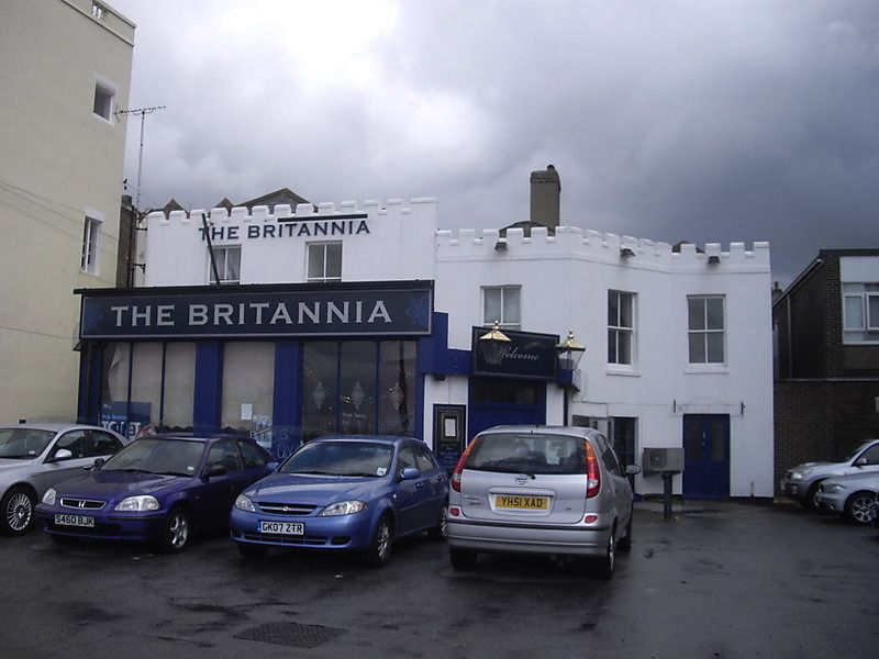
Britannia Hotel Public House.
TR 3571 SE 3/161
II
2.
Mid C19. 2 storeys and basement stuccoed. Slate roof with castellated
parapet. 5 sashes with verticals only. Early C19 bar front. Right side
simple cambered doorcase.
Listing NGR: TR3555971265
External links are from the relevant listing authority and, where applicable, Wikidata. Wikidata IDs may be related buildings as well as this specific building. If you want to add or update a link, you will need to do so by editing the Wikidata entry.


Other nearby listed buildings
