Approximate Location Map
Large Map »
Latitude: 52.8125 / 52°48'45"N
Longitude: -1.4732 / 1°28'23"W
OS Eastings: 435602
OS Northings: 324014
OS Grid: SK356240
Mapcode National: GBR 6G7.LCF
Mapcode Global: WHDHD.BKPQ
Plus Code: 9C4WRG7G+2P
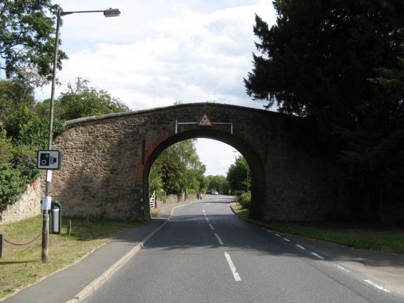
Entry Name: Ticknall Arch
Listing Date: 2 September 1952
Last Amended: 6 January 1987
Grade: II
Source: Historic England
Source ID: 1281697
English Heritage Legacy ID: 82916
ID on this website: 101281697
Location: Ticknall, South Derbyshire, DE73
County: Derbyshire
District: South Derbyshire
Civil Parish: Ticknall
Built-Up Area: Ticknall
Traditional County: Derbyshire
Lieutenancy Area (Ceremonial County): Derbyshire
Church of England Parish: Ticknall St George
Church of England Diocese: Derby
Tagged with: Bridge Architectural structure
PARISH OF TICKNALL MAIN STREET
SK 32 SE
4/109
(Highwayside)
Ticknall Arch (formerly
2-9-52
GV II listed as The Arch)
Arch carrying the tramway from the Ticknall lime-workings to
Ashby. 1794. Rubble sandstone with brick and sandstone
dressings. Single segmental, almost horseshoe arch. Brick
lined. Coped parapet, ramped to centre. the retaining walls
curve out slightly on either side.
Listing NGR: SK3560224014
External links are from the relevant listing authority and, where applicable, Wikidata. Wikidata IDs may be related buildings as well as this specific building. If you want to add or update a link, you will need to do so by editing the Wikidata entry.


Other nearby listed buildings
