Latitude: 51.5076 / 51°30'27"N
Longitude: -2.6315 / 2°37'53"W
OS Eastings: 356270
OS Northings: 178925
OS Grid: ST562789
Mapcode National: GBR JP.J6SG
Mapcode Global: VH88F.BCPN
Plus Code: 9C3VG959+2C
Entry Name: Henbury Lodge
Listing Date: 8 January 1959
Grade: II
Source: Historic England
Source ID: 1282095
English Heritage Legacy ID: 380603
ID on this website: 101282095
Location: Henbury, Bristol, BS10
County: City of Bristol
Electoral Ward/Division: Henbury and Brentry
Parish: Non Civil Parish
Built-Up Area: Bristol
Traditional County: Gloucestershire
Lieutenancy Area (Ceremonial County): Bristol
Church of England Parish: Henbury
Church of England Diocese: Bristol
BRISTOL
ST5678NW STATION ROAD, Henbury 901-1/17/1403 (West side) 08/01/59 Henbury Lodge
II
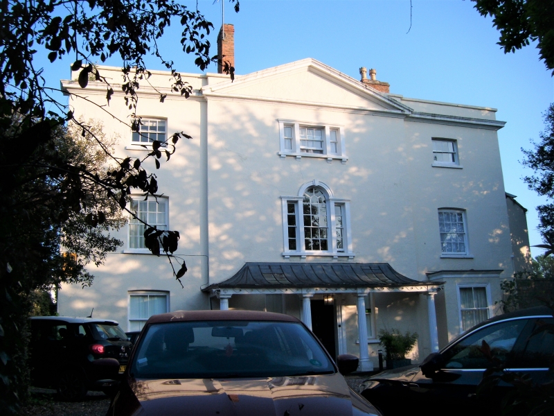
House, now hotel. Late C18. Stucco with limestone dressings, brick end stacks and a slate hip roof. Mid Georgian style. 3 storeys; 3-window range. Projecting pedimented centre has a console canopy above a 6-panel door and flanking plate-glass hall windows below a tented wrought-iron verandah on a Pennant flagged step; cambered heads to plate-glass sashes on the ground floor, 8/8-pane sashes on the first floor, and 4/4-pane sashes on the second floor, with in the centre, below the pediment, a first-floor Venetian window and second-floor tripartite window. INTERIOR: large hall divided by an elliptical arch, open-well stair with wrought-iron balusters, dentil cornice and shutters.
Listing NGR: ST5627078925
External links are from the relevant listing authority and, where applicable, Wikidata. Wikidata IDs may be related buildings as well as this specific building. If you want to add or update a link, you will need to do so by editing the Wikidata entry.


Other nearby listed buildings