Latitude: 51.3186 / 51°19'7"N
Longitude: -1.9157 / 1°54'56"W
OS Eastings: 405972
OS Northings: 157726
OS Grid: SU059577
Mapcode National: GBR 3WV.8HS
Mapcode Global: VHB4P.R33Z
Plus Code: 9C3W839M+CP
Entry Name: 26, Wedhampton
Listing Date: 25 March 1988
Grade: II
Source: Historic England
Source ID: 1284122
English Heritage Legacy ID: 312159
ID on this website: 101284122
Location: Wedhampton, Wiltshire, SN10
County: Wiltshire
Civil Parish: Urchfont
Traditional County: Wiltshire
Lieutenancy Area (Ceremonial County): Wiltshire
Tagged with: Building Thatched cottage
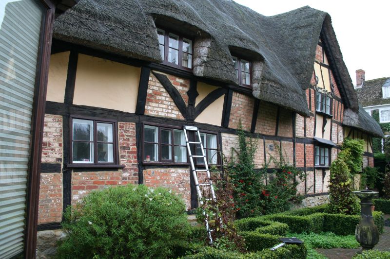
URCHFONT WEDHAMPTON SU 0557 (south side) 11/253 No 26 II Cottage set end to road. Late C17-early C18. Roughcast on timber framing, brick and rubble stonework. Thatched roof. Single storey and attic, one bay with gable stack, extended by second bay beyond stack, and single storey pantiled lean-to. Boarded door to each bay. Timber casement windows. Gable framed with wattle and daub infill. Roof half hipped. Brick stack, and second stack added with lean-to.
Listing NGR: SU0597257726
External links are from the relevant listing authority and, where applicable, Wikidata. Wikidata IDs may be related buildings as well as this specific building. If you want to add or update a link, you will need to do so by editing the Wikidata entry.


Other nearby listed buildings