Latitude: 51.6451 / 51°38'42"N
Longitude: -1.9356 / 1°56'8"W
OS Eastings: 404549
OS Northings: 194030
OS Grid: SU045940
Mapcode National: GBR 3RR.X06
Mapcode Global: VHB2Y.DXK8
Plus Code: 9C3WJ3W7+2P
Entry Name: 12, High Road
Listing Date: 17 April 1986
Grade: II
Source: Historic England
Source ID: 1284481
English Heritage Legacy ID: 317705
ID on this website: 101284481
Location: Ashton Keynes, Wiltshire, SN6
County: Wiltshire
Civil Parish: Ashton Keynes
Built-Up Area: Ashton Keynes
Traditional County: Wiltshire
Lieutenancy Area (Ceremonial County): Wiltshire
Church of England Parish: Ashton Keynes
Church of England Diocese: Bristol
Tagged with: Building
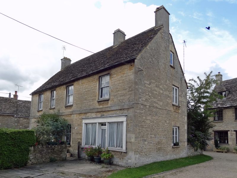
SU 09 SW ASHTON KEYNES HIGH ROAD
(west side)
10/56 No. 12
GV II
House and shop. Late C18. Coursed limestone rubble, stone slate
roof. Two-storey, 4 bays, comprising symmetrical house of 3 bays
with central entrance, and shop in wider right bay. Glazed door to
house and later C19 4-pane sash windows. Plat band. C19 shop
front with central entrance. Gable stacks and stack between house
and shop. Listed for group value.
Listing NGR: SU0454994030
External links are from the relevant listing authority and, where applicable, Wikidata. Wikidata IDs may be related buildings as well as this specific building. If you want to add or update a link, you will need to do so by editing the Wikidata entry.


Other nearby listed buildings