Latitude: 50.9737 / 50°58'25"N
Longitude: -0.3337 / 0°20'1"W
OS Eastings: 517087
OS Northings: 120682
OS Grid: TQ170206
Mapcode National: GBR HKM.SKC
Mapcode Global: FRA B65J.RV9
Plus Code: 9C2XXMF8+FG
Entry Name: Parish Church of St George
Listing Date: 22 September 1959
Grade: I
Source: Historic England
Source ID: 1284797
English Heritage Legacy ID: 299729
Also known as: St George's Church, West Grinstead
ID on this website: 101284797
Location: St George's Church, West Grinstead, Horsham, West Sussex, RH13
County: West Sussex
District: Horsham
Civil Parish: West Grinstead
Traditional County: Sussex
Lieutenancy Area (Ceremonial County): West Sussex
Church of England Parish: West Grinstead St George
Church of England Diocese: Chichester
Tagged with: Church building
WEST GRINSTEAD WEST GRINSTEAD VILLAGE
1.
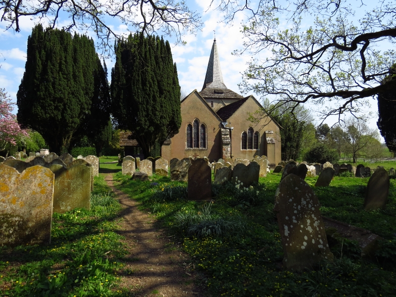
5404 Parish Church of
St George
TQ 12 SE 16/502 22.9.59.
I
2.
Chancel and nave without division between them, south chapel (now the vestry),
central tower, south aisle and west porch. Mostly C13 but containing some
C12 work: South or Burrell Memorial chapel C15. Timber-framed porch. Broached
shingled spire to the tower. C18 or earlier pews with the names of the farm
painted on them. Good memorials to the Burrell family by Rysbrack, Nathaniel
Smith and Flaxman. Good medieval building.
Listing NGR: TQ1708620682
External links are from the relevant listing authority and, where applicable, Wikidata. Wikidata IDs may be related buildings as well as this specific building. If you want to add or update a link, you will need to do so by editing the Wikidata entry.


Other nearby listed buildings