Latitude: 51.7113 / 51°42'40"N
Longitude: -0.9416 / 0°56'29"W
OS Eastings: 473223
OS Northings: 201921
OS Grid: SP732019
Mapcode National: GBR C2L.NRH
Mapcode Global: VHDVN.M7KZ
Plus Code: 9C3XP365+G9
Entry Name: Ryders Farmhouse
Listing Date: 18 July 1963
Grade: II
Source: Historic England
Source ID: 1285339
English Heritage Legacy ID: 249100
ID on this website: 101285339
Location: Sydenham, South Oxfordshire, OX39
County: Oxfordshire
District: South Oxfordshire
Civil Parish: Sydenham
Traditional County: Oxfordshire
Lieutenancy Area (Ceremonial County): Oxfordshire
Church of England Parish: Chinnor, Sydenham, Aston and Crowell
Church of England Diocese: Oxford
Tagged with: Farmhouse
SYDENHAM SP7301 13/86 Ryder's Farmhouse 18/07/63
GV II
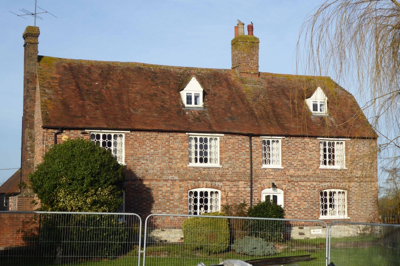
Farmhouse. Late C17. Coursed stone rubble plinth; red brick with flared headers in Flemish bond; old plain-tile roof, half-hipped to right; brick ridge stack to right of centre, end stack to left. 3-unit lobby-entry plan. 2 storeys and attic; 4-window range. 4-panel part-glazed door with segmental brick head to right of centre. 3-light wood casements to ground floor with segmental brick heads and decorative glazing bars. Flat brick band between ground and first floors. 3-light wood casements to first floor, except 2-light wood casement to right of centre, all with decorative glazing bars. 2 gabled dormers. Interior not inspected.
Listing NGR: SP7322301921
External links are from the relevant listing authority and, where applicable, Wikidata. Wikidata IDs may be related buildings as well as this specific building. If you want to add or update a link, you will need to do so by editing the Wikidata entry.


Other nearby listed buildings