Latitude: 52.0941 / 52°5'38"N
Longitude: 0.6688 / 0°40'7"E
OS Eastings: 582918
OS Northings: 247334
OS Grid: TL829473
Mapcode National: GBR QGP.MY2
Mapcode Global: VHJHF.JMYJ
Plus Code: 9F423MV9+JG
Entry Name: 53 and 55, Egremont Street
Listing Date: 9 February 1978
Grade: II
Source: Historic England
Source ID: 1285471
English Heritage Legacy ID: 277941
ID on this website: 101285471
Location: Glemsford, Babergh, Suffolk, CO10
County: Suffolk
District: Babergh
Civil Parish: Glemsford
Built-Up Area: Glemsford
Traditional County: Suffolk
Lieutenancy Area (Ceremonial County): Suffolk
Church of England Parish: Glemsford
Church of England Diocese: St.Edmundsbury and Ipswich
Tagged with: Building
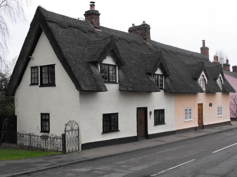
EGREMONT STREET
1.
5377 (East Side)
Glemsford
Nos 53 and 55
TL 8247 19/146
II GV
2.
C18 timber-framed and plastered cottages. 1 storey and attics. Small
casement windows. 2 doorways. Roof thatched, with 2 gabled dormers,
slate roofed.
Listing NGR: TL8291847334
External links are from the relevant listing authority and, where applicable, Wikidata. Wikidata IDs may be related buildings as well as this specific building. If you want to add or update a link, you will need to do so by editing the Wikidata entry.


Other nearby listed buildings