Approximate Location Map
Large Map »
Latitude: 52.0362 / 52°2'10"N
Longitude: 0.7275 / 0°43'39"E
OS Eastings: 587180
OS Northings: 241047
OS Grid: TL871410
Mapcode National: GBR QHJ.BRN
Mapcode Global: VHKF9.K2HV
Plus Code: 9F422PPH+F2
Entry Name: 51, Friars Street
Listing Date: 26 October 1971
Grade: II
Source: Historic England
Source ID: 1285493
English Heritage Legacy ID: 276003
ID on this website: 101285493
Location: Sudbury, Babergh, Suffolk, CO10
County: Suffolk
District: Babergh
Civil Parish: Sudbury
Built-Up Area: Sudbury
Traditional County: Suffolk
Lieutenancy Area (Ceremonial County): Suffolk
Church of England Parish: Sudbury St Gregory with Chilton St Peter
Church of England Diocese: St.Edmundsbury and Ipswich
Tagged with: Building
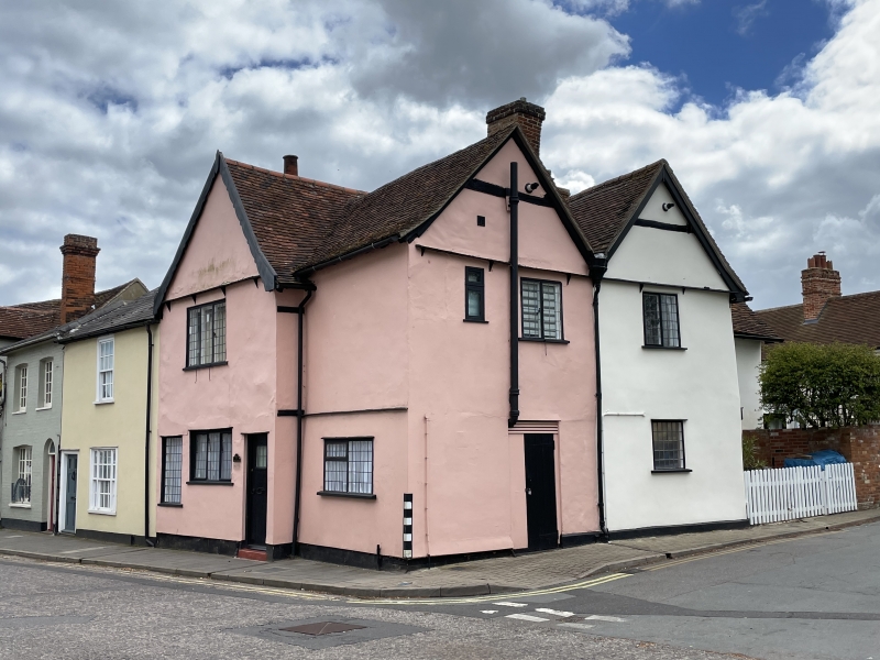
1. FRIARS STREET
1692
(South East Side)
No 51
TL 8741 3/59
II GV
2.
Probably C17 but much altered and modernised. 2 storey, timber framed and
plastered, roofs tiled. 1 front gable and 2 gables on Quay Lane side. NMR
photo.
Nos 27 to 31 (odd), The Friars, Nos 33 to 45 (odd), Nos 49 and 51 form a
group.
Listing NGR: TL8718041047
External links are from the relevant listing authority and, where applicable, Wikidata. Wikidata IDs may be related buildings as well as this specific building. If you want to add or update a link, you will need to do so by editing the Wikidata entry.


Other nearby listed buildings
