Approximate Location Map
Large Map »
Latitude: 51.0499 / 51°2'59"N
Longitude: 0.2309 / 0°13'51"E
OS Eastings: 556463
OS Northings: 130204
OS Grid: TQ564302
Mapcode National: GBR MQW.562
Mapcode Global: FRA C6CB.XCQ
Plus Code: 9F3226XJ+X8
Entry Name: Pippins Russetts
Listing Date: 31 December 1982
Grade: II
Source: Historic England
Source ID: 1285844
English Heritage Legacy ID: 296665
ID on this website: 101285844
Location: Town Row, Wealden, East Sussex, TN6
County: East Sussex
District: Wealden
Civil Parish: Rotherfield
Built-Up Area: Town Row
Traditional County: Sussex
Lieutenancy Area (Ceremonial County): East Sussex
Church of England Parish: Rotherfield St Denys
Church of England Diocese: Chichester
Tagged with: Architectural structure
ROTHERFIELD STATION ROAD
1.
5208
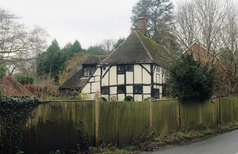
Pippins and Russetts
TQ 53 SE 14/236
II
2.
One building. C17 or earlier timber-framed building with plaster infilling
and diagonal braces on first floor. Steeply-pitched tiled roof, hipped at
east end. Casement windows. Two storeys. Three windows.
Listing NGR: TQ5646330204
External links are from the relevant listing authority and, where applicable, Wikidata. Wikidata IDs may be related buildings as well as this specific building. If you want to add or update a link, you will need to do so by editing the Wikidata entry.


Other nearby listed buildings
