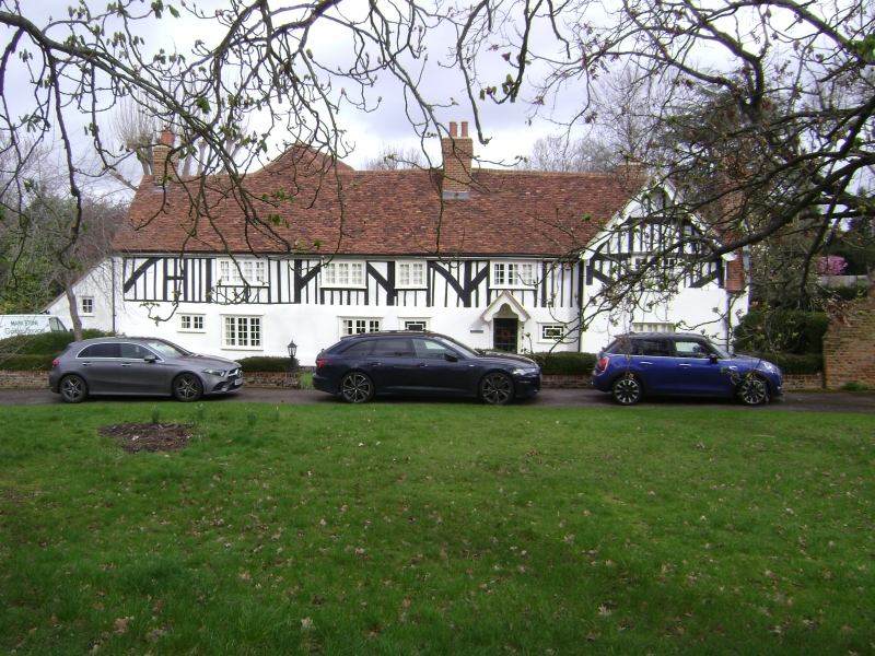
Latitude: 51.595 / 51°35'42"N
Longitude: -0.3799 / 0°22'47"W
OS Eastings: 512320
OS Northings: 189705
OS Grid: TQ123897
Mapcode National: GBR 4D.4XC
Mapcode Global: VHFT0.C5JL
Plus Code: 9C3XHJWC+23
Entry Name: Church Farmhouse
Listing Date: 21 September 1951
Last Amended: 27 January 1984
Grade: II
Source: Historic England
Source ID: 1285921
English Heritage Legacy ID: 202143
ID on this website: 101285921
Location: Pinner, Harrow, London, HA5
County: London
District: Harrow
Electoral Ward/Division: Pinner
Parish: Non Civil Parish
Built-Up Area: Harrow
Traditional County: Middlesex
Lieutenancy Area (Ceremonial County): Greater London
Church of England Parish: St John Pinner
Church of England Diocese: London
Tagged with: Farmhouse
In the entry for PAINES LANE Pinner 12/13 Church Farmhouse The address shall be amended to read: PAINE'S LANE Pinner Church Farmhouse
------------------------------------
PAINES LANE 1. 5016 Pinner Church Farmhouse TQ 1289 NW 12/13 21.9.51
II
2. On corner of High Street set back. C17, altered considerably in C18, now roughcast and having Victorian barge-boarding and porch. F-shaped plan, long and low. Old tile roof, hipped and gabled. Interior is panelled, with fire places. (RCHM).
Listing NGR: TQ1232089705
External links are from the relevant listing authority and, where applicable, Wikidata. Wikidata IDs may be related buildings as well as this specific building. If you want to add or update a link, you will need to do so by editing the Wikidata entry.


Other nearby listed buildings