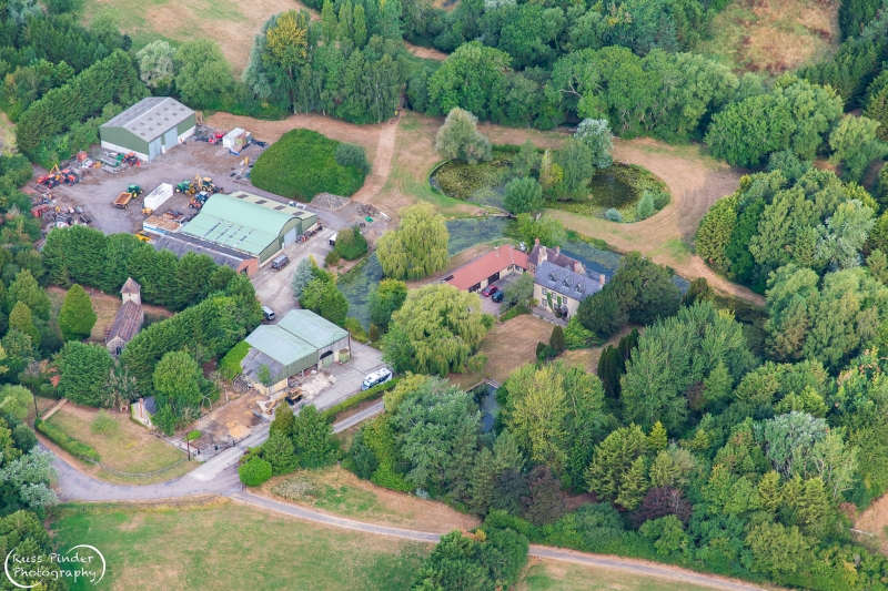
Latitude: 51.9461 / 51°56'45"N
Longitude: -1.0664 / 1°3'59"W
OS Eastings: 464266
OS Northings: 227922
OS Grid: SP642279
Mapcode National: GBR 9Y6.TFX
Mapcode Global: VHCWZ.GBLZ
Plus Code: 9C3WWWWM+CC
Entry Name: Moat Farmhouse
Listing Date: 26 November 1951
Grade: II
Source: Historic England
Source ID: 1286457
English Heritage Legacy ID: 243622
ID on this website: 101286457
Location: Godington, Cherwell, Oxfordshire, OX27
County: Oxfordshire
District: Cherwell
Civil Parish: Godington
Traditional County: Oxfordshire
Lieutenancy Area (Ceremonial County): Oxfordshire
Church of England Parish: Stratton Audley and Goddington
Church of England Diocese: Oxford
Tagged with: Farmhouse
GODDINGTON MAIN STREET SP62NW (North side) 8/29 Moat Farmhouse 26/11/51
- II
Farmhouse. Dated 1672/CGB on weathervane and WF 1782 an front elevation. 2 abutting ranges. South range. Squared coursed limestone. Steeply pitched slate roof. Stone end stacks. 2 storeys. 4-window range. Ground and first floors have renewed sash windows with glazing bars in original openings with keyblock stone heads. 3 gabled roof dormers. Range abutting to north. Partly timber-framed with red-tile roof and brick end stacks. Renewed windows and doors. Interior not inspected.
Listing NGR: SP6426627922
External links are from the relevant listing authority and, where applicable, Wikidata. Wikidata IDs may be related buildings as well as this specific building. If you want to add or update a link, you will need to do so by editing the Wikidata entry.


Other nearby listed buildings