Approximate Location Map
Large Map »
Latitude: 50.8832 / 50°52'59"N
Longitude: -0.3157 / 0°18'56"W
OS Eastings: 518578
OS Northings: 110652
OS Grid: TQ185106
Mapcode National: GBR HLS.JZJ
Mapcode Global: FRA B67R.SZ6
Plus Code: 9C2XVMMM+7P
Entry Name: Bramber Castle Ruins
Listing Date: 15 March 1955
Grade: I
Source: Historic England
Source ID: 1286805
English Heritage Legacy ID: 298336
ID on this website: 101286805
Location: Bramber, Horsham, West Sussex, BN44
County: West Sussex
District: Horsham
Civil Parish: Bramber
Built-Up Area: Upper Beeding
Traditional County: Sussex
Lieutenancy Area (Ceremonial County): West Sussex
Church of England Parish: Beeding St Peter and Bramber St Nicholas
Church of England Diocese: Chichester
Tagged with: Architectural structure
BRAMBER THE STREET
1. (north side)
5404
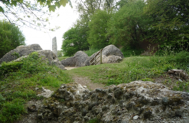
Bramber Castle Ruins
TQ 1810 25/44 15.3.55
I
2.
National Trust. Scheduled Ancient Monument.
Fragments, one about 50 ft high, of the Norman motte and bailey castle probably
built by the first William de Braose.
Listing NGR: TQ1858010653
External links are from the relevant listing authority and, where applicable, Wikidata. Wikidata IDs may be related buildings as well as this specific building. If you want to add or update a link, you will need to do so by editing the Wikidata entry.


Other nearby listed buildings
