Latitude: 50.7278 / 50°43'40"N
Longitude: -2.7583 / 2°45'29"W
OS Eastings: 346577
OS Northings: 92292
OS Grid: SY465922
Mapcode National: GBR PP.0R1H
Mapcode Global: FRA 5735.3UF
Plus Code: 9C2VP6HR+4M
Entry Name: 158, South Street
Listing Date: 19 September 1975
Grade: II
Source: Historic England
Source ID: 1287139
English Heritage Legacy ID: 402956
ID on this website: 101287139
Location: New Zealand, Dorset, DT6
County: Dorset
Civil Parish: Bridport
Built-Up Area: Bridport
Traditional County: Dorset
Lieutenancy Area (Ceremonial County): Dorset
Church of England Parish: Bridport St Mary
Church of England Diocese: Salisbury
Tagged with: Building
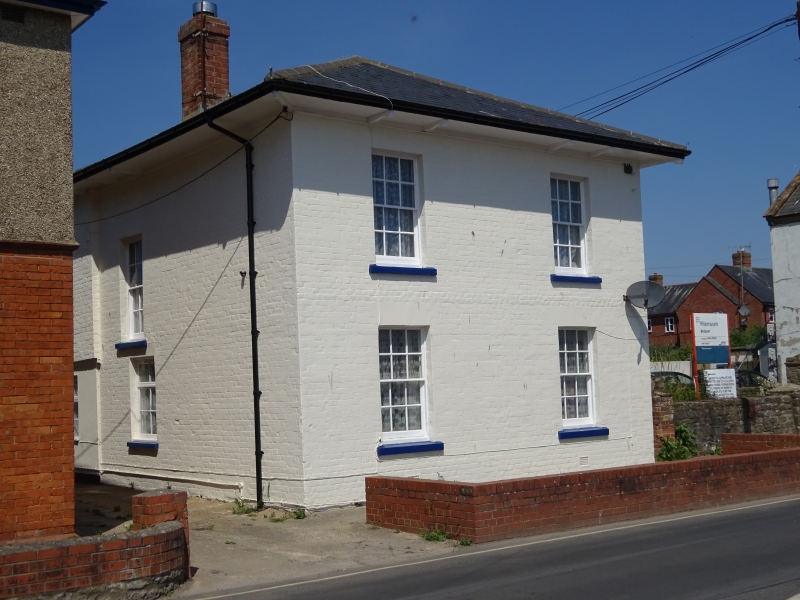
1.
5191 SOUTH STREET
(West Side)
SY 4692 4/462 No 158
II
2.
Early C19. Colour washed brick. Hipped slate roof with deeply overhanging
eaves on cut brackets. 2 storeys. 2 ranges of sashes with glazing bars on
front, 1 on sides. Small 2-storey extensions to north.
Listing NGR: SY4657792292
External links are from the relevant listing authority and, where applicable, Wikidata. Wikidata IDs may be related buildings as well as this specific building. If you want to add or update a link, you will need to do so by editing the Wikidata entry.


Other nearby listed buildings