Latitude: 53.272 / 53°16'19"N
Longitude: -2.562 / 2°33'43"W
OS Eastings: 362616
OS Northings: 375149
OS Grid: SJ626751
Mapcode National: GBR BZKL.4S
Mapcode Global: WH99B.M06Y
Plus Code: 9C5V7CCQ+R5
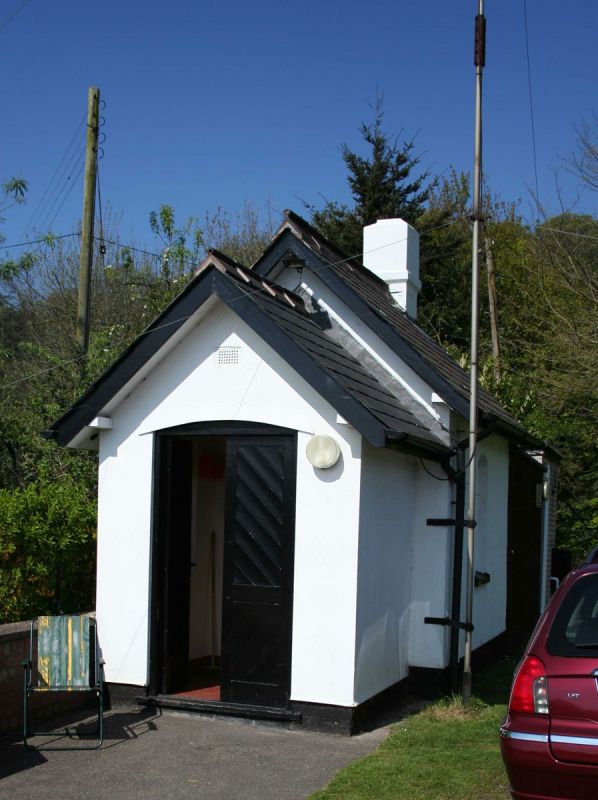
Entry Name: Tollhouse at Saltersford Locks
Listing Date: 18 July 1986
Grade: II
Source: Historic England
Source ID: 1287506
English Heritage Legacy ID: 402158
ID on this website: 101287506
Location: Barnton, Cheshire West and Chester, Cheshire, CW8
County: Cheshire West and Chester
Civil Parish: Barnton
Traditional County: Cheshire
Lieutenancy Area (Ceremonial County): Cheshire
Church of England Parish: Barnton Christ Church
Church of England Diocese: Chester
Tagged with: Tollhouse
BARNTON C.P. WEAVER NAVIGATION SJ 67 NW 6261 7515 2/18 Tollhouse at Saltersford Locks - GV II
River lock tollhouse: late C19 for Weaver Navigation Co. Washed and rendered brick, Welsh slate roof, gable brick chimney. Small one-roomed building. To the front is a door with a segmental head and a small pane window in each side.
Included for group value.
Listing NGR: SJ6261675149
External links are from the relevant listing authority and, where applicable, Wikidata. Wikidata IDs may be related buildings as well as this specific building. If you want to add or update a link, you will need to do so by editing the Wikidata entry.


Other nearby listed buildings