Latitude: 50.704 / 50°42'14"N
Longitude: -3.2278 / 3°13'40"W
OS Eastings: 313391
OS Northings: 90088
OS Grid: SY133900
Mapcode National: GBR P8.W9XQ
Mapcode Global: FRA 4746.SDH
Plus Code: 9C2RPQ3C+HV
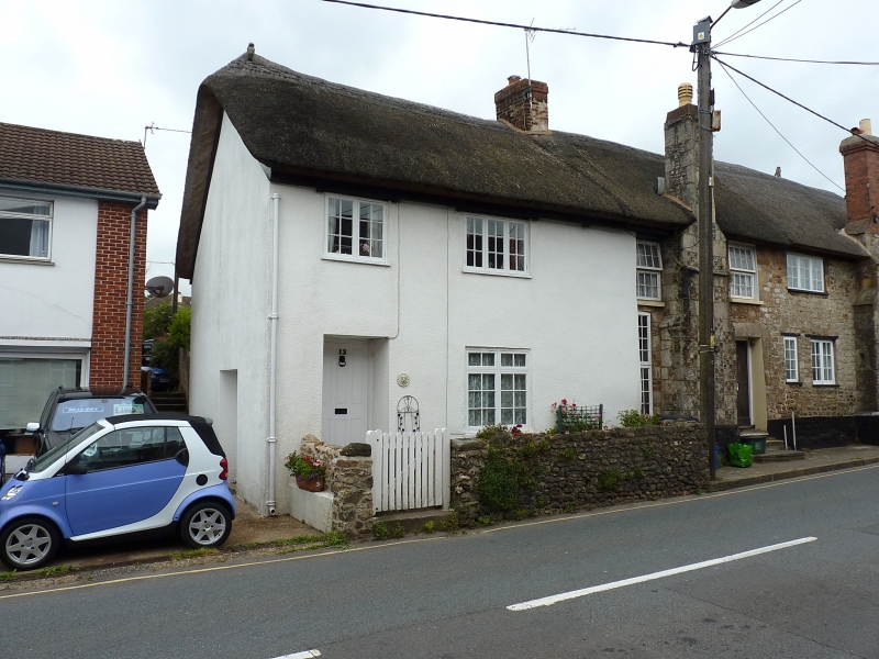
Entry Name: Crossways Cottage
Listing Date: 12 November 1973
Grade: II
Source: Historic England
Source ID: 1287605
English Heritage Legacy ID: 401937
ID on this website: 101287605
Location: Sidford, East Devon, EX10
County: Devon
District: East Devon
Civil Parish: Sidmouth
Built-Up Area: Sidmouth
Traditional County: Devon
Lieutenancy Area (Ceremonial County): Devon
Church of England Parish: Sidbury with Sidford
Church of England Diocese: Exeter
Tagged with: Cottage Thatched cottage
SCHOOL STREET,SIDFORD 1. 1633 (West Side) Crossways Cottage SY 1390 4/354 II GV 2. Altered 2 storey cob cottage. Roof thatched to rear, front pitch is slate. Rough cast facing. 2 casements. Door of 6 vertical flush panels.
Nos 1 to 7 (consec), British Legion Hall, Nos 8 to 12 (consec) and Crossways Cottage form a group.
Listing NGR: SY1339190088
External links are from the relevant listing authority and, where applicable, Wikidata. Wikidata IDs may be related buildings as well as this specific building. If you want to add or update a link, you will need to do so by editing the Wikidata entry.


Other nearby listed buildings