Latitude: 51.9734 / 51°58'24"N
Longitude: -0.7732 / 0°46'23"W
OS Eastings: 484367
OS Northings: 231254
OS Grid: SP843312
Mapcode National: GBR D11.9B4
Mapcode Global: VHDTD.KN3L
Plus Code: 9C3XX6FG+8P
Entry Name: Ivy Lodge Farmhouse
Listing Date: 26 July 1977
Last Amended: 29 May 1984
Grade: II
Source: Historic England
Source ID: 1287692
English Heritage Legacy ID: 401364
ID on this website: 101287692
Location: Newton Longville, Buckinghamshire, MK17
County: Buckinghamshire
Civil Parish: Newton Longville
Built-Up Area: Newton Longville
Traditional County: Buckinghamshire
Lieutenancy Area (Ceremonial County): Buckinghamshire
Church of England Parish: Newton Longville
Church of England Diocese: Oxford
Tagged with: Farmhouse Thatched farmhouse
SP 83 SW
2/122
26.7.77
NEWTON LONGVILLE
WESTBROOK END
(west side)
No. 46 (Ivy Lodge Farmhouse)
(formerly listed as Ivy Farmhouse)
GV
II
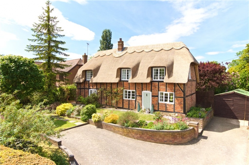
House. C15-C16, altered C17. Timber frame with brick infill and rubble
stone plinth. Centre bay has flanking cruck trusses. Half-hipped thatch
roof. Chimney of C17 brick, repointed, between left-hand bays. 1½
storeys, 3 bays. Barred wooden casements, 3-light to ground floor,
right-hand bays, remainder 2-light, upper windows in thatch. Flush
panelled door between right-hand bays in plain wooden frame with
segmental head. Extended to rear C20. Interior has fireplace with
moulded stone jambs and wooden lintel.
RCHM II p 218 MON 31
Listing NGR: SP8436731254
External links are from the relevant listing authority and, where applicable, Wikidata. Wikidata IDs may be related buildings as well as this specific building. If you want to add or update a link, you will need to do so by editing the Wikidata entry.


Other nearby listed buildings