Latitude: 50.7356 / 50°44'8"N
Longitude: -2.7646 / 2°45'52"W
OS Eastings: 346135
OS Northings: 93167
OS Grid: SY461931
Mapcode National: GBR PP.039J
Mapcode Global: FRA 5734.DRD
Plus Code: 9C2VP6PP+64
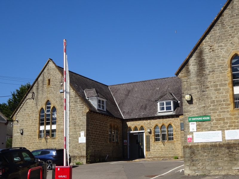
Entry Name: St Swithun's Church Hall Including Wall to Street
Listing Date: 19 September 1975
Grade: II
Source: Historic England
Source ID: 1287731
English Heritage Legacy ID: 401579
ID on this website: 101287731
Location: Allington, Dorset, DT6
County: Dorset
Civil Parish: Bridport
Built-Up Area: Bridport
Traditional County: Dorset
Lieutenancy Area (Ceremonial County): Dorset
Church of England Parish: Bridport St Mary
Church of England Diocese: Salisbury
Tagged with: Architectural structure
1. 5191 NORTH ALLINGTON (West Side)
St Swithun's Church Hall, including wall to street SY 4693 2/304
II
2. Mid C19. Former school. Hammer dressed stone. Pitched slate roof. Coped gable ends on kneelers, 1 storey. Plinth. U-shaped plan with projecting porch in north wing. 2 and 3-light grouped lancets with single chamfers. Slightly projecting chimneybreast. 2 planked doors with ornamental hinges in chamfered pointed arches. Former playground wall: hammer dressed stone: ashlar coping: piers at either end with pyramidal caps: raised centre with arched entrance and iron gates.
Listing NGR: SY4613893168
External links are from the relevant listing authority and, where applicable, Wikidata. Wikidata IDs may be related buildings as well as this specific building. If you want to add or update a link, you will need to do so by editing the Wikidata entry.


Other nearby listed buildings