Approximate Location Map
Large Map »
Latitude: 50.7908 / 50°47'26"N
Longitude: -2.7536 / 2°45'13"W
OS Eastings: 346974
OS Northings: 99299
OS Grid: SY469992
Mapcode National: GBR MJ.ZD64
Mapcode Global: FRA 5730.51S
Plus Code: 9C2VQ6RW+8G
Entry Name: Methodist Chapel
Listing Date: 31 July 1984
Grade: II
Source: Historic England
Source ID: 1287784
English Heritage Legacy ID: 401417
ID on this website: 101287784
Location: Netherbury, Dorset, DT6
County: Dorset
Civil Parish: Netherbury
Built-Up Area: Netherbury
Traditional County: Dorset
Lieutenancy Area (Ceremonial County): Dorset
Church of England Parish: Netherbury St Mary
Church of England Diocese: Salisbury
Tagged with: Chapel
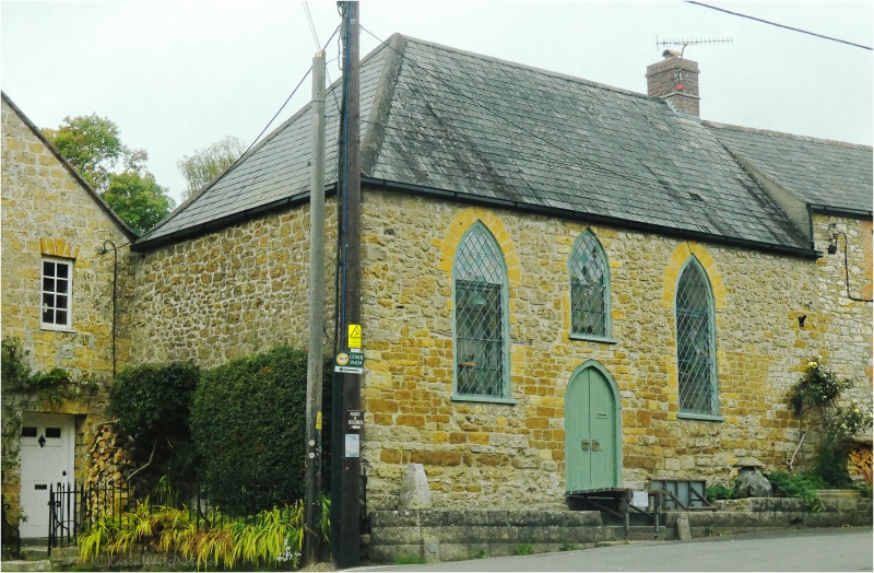
SY 4699/4799 NETHERBURY THE SQUARE
10/164 Methodist Chapel
GV II
Former Methodist Chapel. Early C19. Coursed rubble-stone walls.
Slate roof, hipped at left hand. One brick stack at right hand.
One full storey. 3 lancet windows, with dressed arch-stones,
wooden window-frames and fixed glazing-bars. Pointed arch door, centre
left, two-leaf, plank.
Listing NGR: SY4697499299
External links are from the relevant listing authority and, where applicable, Wikidata. Wikidata IDs may be related buildings as well as this specific building. If you want to add or update a link, you will need to do so by editing the Wikidata entry.


Other nearby listed buildings
