Approximate Location Map
Large Map »
Latitude: 51.3328 / 51°19'58"N
Longitude: -0.2722 / 0°16'19"W
OS Eastings: 520464
OS Northings: 160717
OS Grid: TQ204607
Mapcode National: GBR 93.VCY
Mapcode Global: VHGRP.7RGN
Plus Code: 9C3X8PMH+44
Entry Name: The White House
Listing Date: 10 April 1954
Grade: II
Source: Historic England
Source ID: 1288771
English Heritage Legacy ID: 398793
ID on this website: 101288771
Location: Epsom, Epsom and Ewell, Surrey, KT18
County: Surrey
District: Epsom and Ewell
Electoral Ward/Division: Town
Parish: Non Civil Parish
Built-Up Area: Epsom
Traditional County: Surrey
Lieutenancy Area (Ceremonial County): Surrey
Church of England Parish: Epsom Common Christ Church
Church of England Diocese: Guildford
Tagged with: House
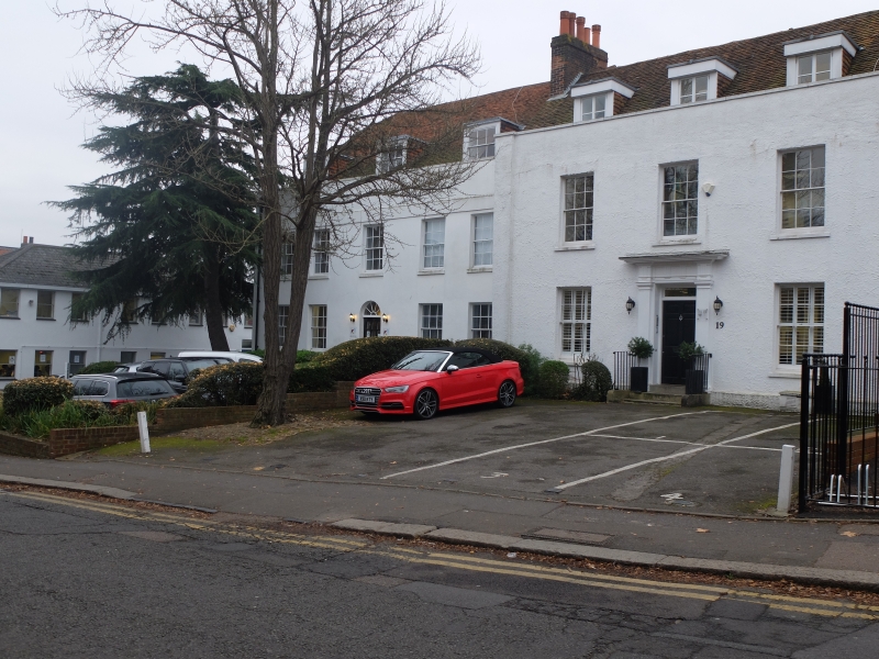
EPSOM
1.
1086
WEST STREET
(South Side)
No 19
TQ 2060 30/84 10.4.54. (The White House)
II GV
2.
Early C18. Two storeys, colourwashed roughcast, three sash windows.
Original central fluted pilastered doorcase, 6 panel door, triglyph frieze
and cornice. Capped parapet, two flat topped dormers, old tile roof.
Nos 17 to 21 (odd) form a group.
Listing NGR: TQ2046460717
External links are from the relevant listing authority and, where applicable, Wikidata. Wikidata IDs may be related buildings as well as this specific building. If you want to add or update a link, you will need to do so by editing the Wikidata entry.


Other nearby listed buildings
