Latitude: 51.4674 / 51°28'2"N
Longitude: -1.205 / 1°12'17"W
OS Eastings: 455321
OS Northings: 174564
OS Grid: SU553745
Mapcode National: GBR 92H.VKR
Mapcode Global: VHCZ7.2CBZ
Plus Code: 9C3WFQ8W+W2
Entry Name: Wall Adjoining the Grange to the South
Listing Date: 29 November 1983
Grade: II
Source: Historic England
Source ID: 1288821
English Heritage Legacy ID: 398598
ID on this website: 101288821
Location: Yattendon, West Berkshire, RG18
County: West Berkshire
Civil Parish: Yattendon
Traditional County: Berkshire
Lieutenancy Area (Ceremonial County): Berkshire
Church of England Parish: Yattendon and Frilsham
Church of England Diocese: Oxford
Tagged with: Wall
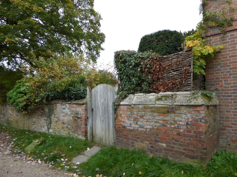
YATTENDON YATTENDON SU 5574 11/5 Wall Adjoining The Grange To The South GV II Wall. C18 and later. Approximately 45 metres long and 2 metres high. Red brick with flint, tile, rubble and some carved stones. Partly brick and partly moulded stone coping. 5 brick buttresses to south and boarded door to north.
Listing NGR: SU5532174566
External links are from the relevant listing authority and, where applicable, Wikidata. Wikidata IDs may be related buildings as well as this specific building. If you want to add or update a link, you will need to do so by editing the Wikidata entry.


Other nearby listed buildings