Latitude: 51.7721 / 51°46'19"N
Longitude: -0.9938 / 0°59'37"W
OS Eastings: 469520
OS Northings: 208638
OS Grid: SP695086
Mapcode National: GBR B0F.TSY
Mapcode Global: VHDV7.QQGC
Plus Code: 9C3XQ2C4+RF
Entry Name: Number 20 (Notley Farmhouse) and Stone Boundary Wall on South to Jesse's Lane
Listing Date: 19 June 1981
Grade: II
Source: Historic England
Source ID: 1288888
English Heritage Legacy ID: 398487
ID on this website: 101288888
Location: Long Crendon, Buckinghamshire, HP18
County: Buckinghamshire
Civil Parish: Long Crendon
Built-Up Area: Long Crendon
Traditional County: Buckinghamshire
Lieutenancy Area (Ceremonial County): Buckinghamshire
Church of England Parish: Long Crendon
Church of England Diocese: Oxford
Tagged with: Agricultural structure
1. 5132 LONG CRENDON HIGH STREET (south-east side)
No 20 (Notley Farmhouse) and stone boundary wall on south to Jesse's Lane SP 6908 2/82 II GV
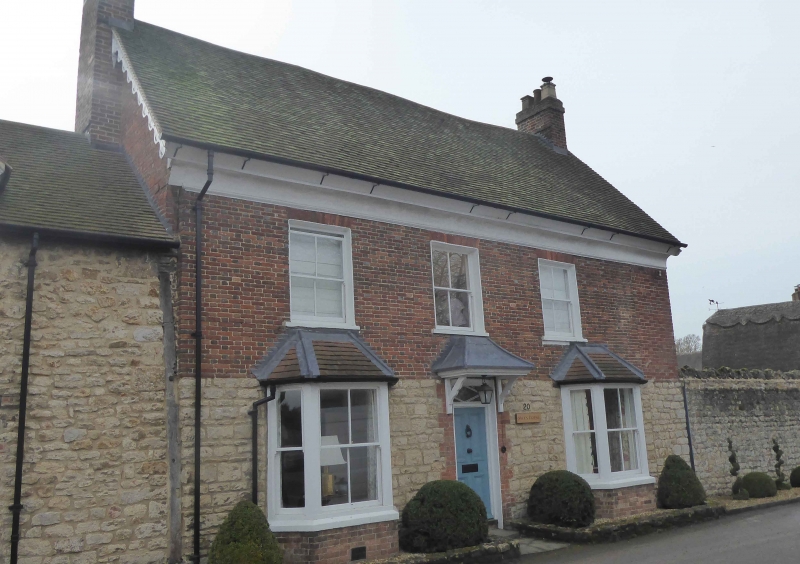
2. C18 refronting of older timber-framed house. Altered 1874. Rubble stone ground floor, brick above with coved plaster cornice. Old tile roof, C19 ornamental gable bargeboards. Three bay front, 4 panel central door with diamond pattern fanlight, flanked by C19 canted bays with hipped tiled roofs. Two sashes above and painted blank recess over door. South gable has 2 small attic windows. Garden elevation has cornice and dormers similar to front and a circular window to centre of first floor. One storey and attic rubble stone wing to north, 3 varying windows to ground floor, 2-light gabled dormer above with C19 shaped bargeboard. One window north gable, a 3-light below sash above. Rubble stone boundary wall and barn close by. High rubble stone wall on south continuing along Jesse's Lane.
Listing NGR: SP6952008638
External links are from the relevant listing authority and, where applicable, Wikidata. Wikidata IDs may be related buildings as well as this specific building. If you want to add or update a link, you will need to do so by editing the Wikidata entry.


Other nearby listed buildings