Approximate Location Map
Large Map »
Latitude: 53.63 / 53°37'48"N
Longitude: -1.7554 / 1°45'19"W
OS Eastings: 416270
OS Northings: 414860
OS Grid: SE162148
Mapcode National: GBR JV5G.RG
Mapcode Global: WHCB8.00CZ
Plus Code: 9C5WJ6JV+2R
Entry Name: Broken Cross
Listing Date: 29 September 1978
Grade: II
Source: Historic England
Source ID: 1288920
English Heritage Legacy ID: 340038
ID on this website: 101288920
Location: Benomley, Kirklees, West Yorkshire, HD5
County: Kirklees
Electoral Ward/Division: Almondbury
Parish: Non Civil Parish
Built-Up Area: Huddersfield
Traditional County: Yorkshire
Lieutenancy Area (Ceremonial County): West Yorkshire
Church of England Parish: Almondbury with Farnley Tyas Team Parish
Church of England Diocese: Leeds
Tagged with: Building Architectural structure
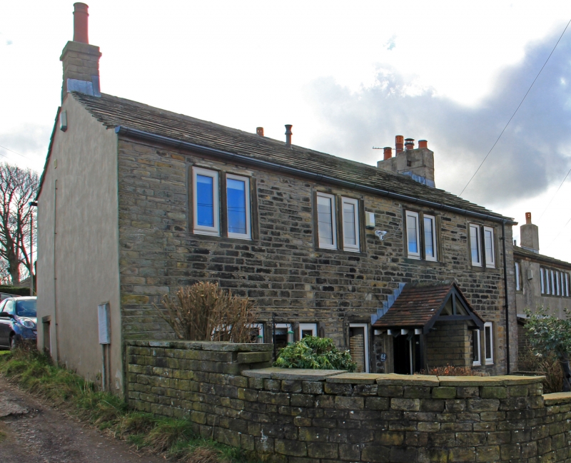
1.
5113
SE 1614 45/1414
KAYE LANE (North Side)
Nos 42 and 44 Broken Cross
II
2.
C18 or C19. Hammer dressed stone. Pitched stone slate roof. 2 storeys.
Four 2-light stone mullioned windows on 1st floor, two 4-light stone mullioned
windows on ground floor. Door with 4 moulded panels.
Listing NGR: SE 16270 14860
External links are from the relevant listing authority and, where applicable, Wikidata. Wikidata IDs may be related buildings as well as this specific building. If you want to add or update a link, you will need to do so by editing the Wikidata entry.


Other nearby listed buildings
