Approximate Location Map
Large Map »
Latitude: 50.3383 / 50°20'17"N
Longitude: -4.7962 / 4°47'46"W
OS Eastings: 201120
OS Northings: 52450
OS Grid: SX011524
Mapcode National: GBR ZX.9X2N
Mapcode Global: FRA 08V4.M90
Plus Code: 9C2Q86Q3+8G
Entry Name: 13 and 15, Truro Road
Listing Date: 11 March 1974
Grade: II
Source: Historic England
Source ID: 1289639
English Heritage Legacy ID: 396598
ID on this website: 101289639
Location: St Austell, Cornwall, PL25
County: Cornwall
Civil Parish: St Austell
Built-Up Area: St Austell
Traditional County: Cornwall
Lieutenancy Area (Ceremonial County): Cornwall
Church of England Parish: St Austell
Church of England Diocese: Truro
Tagged with: Building
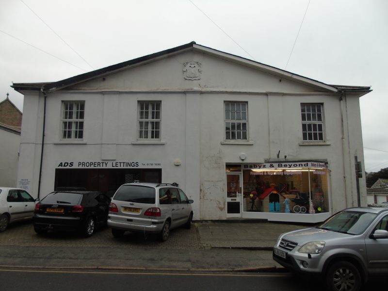
ST AUSTELL
1. TRURO ROAD
1584A
Nos 13 & 15
SX 0152 1/530
II GV
2.
C19, plain, stucco. 2 storeys, 4 windows, sashes with glazing bars.
Quoin pilasters. Eaves course: low and wide pediment with coat of arms
in centre. No 15 has large modern projecting shop front. Entrances at
sides. Slate hipped roof.
Nos 9 to 15 (odd) form a group.
Listing NGR: SX0112052450
External links are from the relevant listing authority and, where applicable, Wikidata. Wikidata IDs may be related buildings as well as this specific building. If you want to add or update a link, you will need to do so by editing the Wikidata entry.


Other nearby listed buildings
