Latitude: 54.4024 / 54°24'8"N
Longitude: -1.7402 / 1°44'24"W
OS Eastings: 416960
OS Northings: 500800
OS Grid: NZ169008
Mapcode National: GBR JK9J.1M
Mapcode Global: WHC6D.7LKX
Plus Code: 9C6WC725+XW
Entry Name: Cobble Stones on Roadway, North of Junction with New Road
Listing Date: 15 October 1973
Grade: II
Source: Historic England
Source ID: 1289912
English Heritage Legacy ID: 322868
ID on this website: 101289912
Location: Richmond, North Yorkshire, DL10
County: North Yorkshire
District: Richmondshire
Civil Parish: Richmond
Built-Up Area: Richmond
Traditional County: Yorkshire
Lieutenancy Area (Ceremonial County): North Yorkshire
Church of England Parish: Richmond with Holy Trinity with Hudswell
Church of England Diocese: Leeds
Tagged with: Architectural structure Road surface
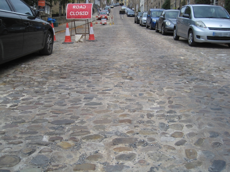
1. BARGATE
1549 Cobble stones on
Roadway, North of
junction with
New Road
NZ 1600 NE 5/310
II GV
2.
Cobble roadway.
The Cobbled Roadway forms a group with the listed buildings in Bargate
Listing NGR: NZ1696000800
External links are from the relevant listing authority and, where applicable, Wikidata. Wikidata IDs may be related buildings as well as this specific building. If you want to add or update a link, you will need to do so by editing the Wikidata entry.


Other nearby listed buildings